
We haven’t published many ten-part editorials in the Daily Post over the past 15 years. But we also don’t come across many political issues — local, state, or national — as complicated or as perplexing as the declining lake levels in the two largest reservoirs situated on the Colorado River: Lake Mead and Lake Powell.
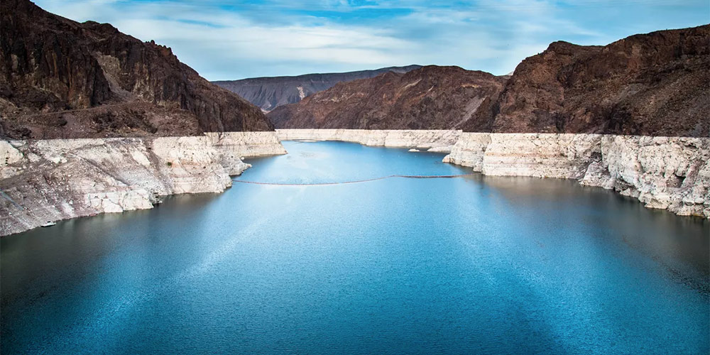
In the summer of 2016, Lake Mead – the largest reservoir in the US as measured by theoretical capacity – had declined to its lowest level since the reservoir was still being filled in the 1930s. It had contained a record 26.8 million acre feet in 1983, but stood at about only 9.3 million acre feet in the spring of 2016.
Given the basic apportionments to the Lower Basin states, the allotment to Mexico, and evaporation losses, Lake Mead annual outflow is about 1.2 million acre-feet more than the annual inflow. The result has been an imbalance that caused Lake Mead to drop by 12 feet or more every year.
Lake Powell also hit a record high in 1983 — 25 million acre feet — but fell to as low as about 9.5 million acre feet in 2018. Practically speaking, the water in Lake Powell is ultimately destined for Lake Mead, 280 miles downstream.
Both lakes are doing slightly better this year. Slightly.
To hear some folks tell the story, Colorado and the American West are seeing less snowfall and rainfall due to certain effects of climate change — and are destined to see less and less throughout the rest of the 21st century. One number that’s been quoted by folks such as the ‘For the Love of Colorado’ political coalition was published by a couple of concerned researchers from Colorado State University, Brad Udall and Jonathan Overpeck. The two researchers have warned of diminished flows in the Colorado River by 2050 — up to 35% less than the average 20th century flows.
You can read a summary of their research here. From that summary:
Using simple but strong relationships derived from hydrology models, which were buttressed by observations, we and our colleagues calculated how river flows are affected by higher temperatures. We found that Colorado River flows decline by about 4 percent per degree Fahrenheit increase, which is roughly the same amount as the increased atmospheric water vapor holding capacity discussed above. Thus, warming could reduce water flow in the Colorado by 20 percent or more below the 20th-century average by midcentury, and by as much as 40 percent by the end of the century.
Mr. Udall and Mr. Overpeck shared a chart in support of their theory, suggesting that the drought during the 1950s was based on a lack of precipitation, while the drought we just came out of was driven by climate change.
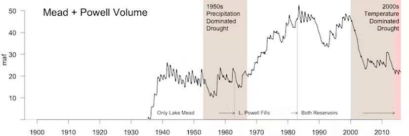
One curious thing about reservoirs, like the two combined in this chart (Mead and Powell.) The water levels are dependent upon more than ‘inflows.’ The levels are also dependent on ‘outflows.’ The levels in Lake Mead and Lake Powell depend just as much on the amount of water sucked out of them — by the agricultural industry and by other (less demanding) water users — as it does on the amount of water flowing into them. A chart that merely shows “volume levels” reveals only a part of the story.
From the research I’ve been doing over the past two weeks, it appears that water districts across the American Southwest do not always keep accurate records of how much water they’re extracting from the Colorado River and its numerous reservoirs. Here’s a comment from “California Hasn’t Come Clean About Its Water Use During the Drought” — a story by reporter Corey Binns, published on the Natural Resources Defense Council website last summer:
Under a bill enacted in 2007, irrigation districts that supply water to farms are required to report to the California Department of Water Resources (DWR) how much water they deliver to farmers’ fields each year. The law took effect in 2012 — soon after the start of the record-breaking, multiyear drought — but a recent investigation by NRDC found that only 12 percent of the state’s largest irrigation districts had turned in all of the required reports, and 28 percent had never turned in any report, as of 2017.
For example. According to a 2017 article by reporters Ryan Sabalow and Phillip Reese published in the Fresno Bee, the Imperial Irrigation District (IID) claims to be the largest irrigation district in the nation. The agency filed a report in the 2012 fiscal year saying it supplied 2.6 million acre-feet of water… but the district didn’t file any reports during the drought years that followed. IID spokesperson Marion Champion said that after filing the first report, the District had an “internal discussion” and determined it was exempt from the requirements.
The Fresno Bee quoted Marty Berbach, a senior environmental scientist at DWR who oversees the required farm reports, as saying that he’s “not aware” of the exemption cited by the IID.
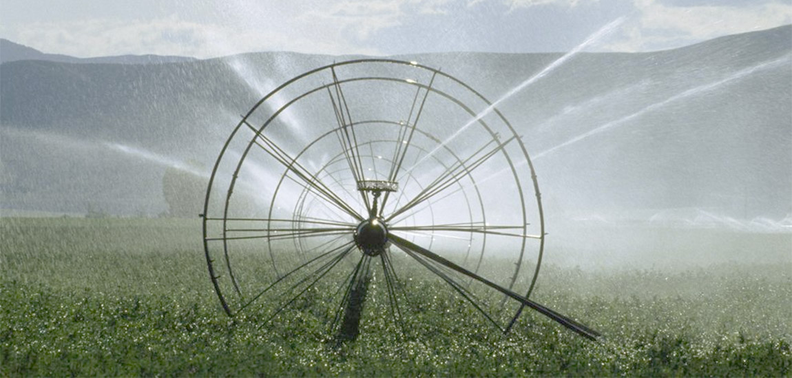
Over the past 150 years, state governments across the American Southwest have granted generous water rights to farmers and ranchers, back when water was flowing like … well, flowing like water. Those water rights have made a few farmers and ranchers extremely wealthy, but in many cases, farming and ranching in America has created conditions of poverty for both laborers and for the farmers themselves. The technology that diverts the water for farm irrigation dates back to the late 1800s, and was never designed to allow farmers or government officials to easily measure or calculate the amount of water used.
For more than a century, here in the American West, we operated on the basic assumption that measuring agricultural water consumption was unnecessary.
It would seem that we, the public, have no way of knowing whether the Imperial Irrigation District in California is indeed sucking 2.6 million acre feet of water from the Colorado River — or if the actual amount is 3.6 million acre feet. Or some other number?
As of 2015, Colorado has a plan: The Colorado Water Plan, written with input from dozens of water experts and taking into account (or so it is claimed) 30,000 comments by ordinary Coloradans.
Does it address the issue of agricultural water use, in a state where perhaps 90 percent of the water is consumed by farms and ranches?
And more pertinent to Archuleta County, does the Colorado Water Plan say anything about agricultural water use in the Pagosa Springs area, where it would appear that ranches and farms account for 98 percent of water consumption?