
So… a bit of history.
Personal history, and academic history. Not necessarily in that order.
When you schedule a family reunion in Juneau, Alaska — a town accessible only by boat or plane — most of the family arrives, of course, without a car, so it’s useful to have someone in the family acting as the on-call chauffeur.
I gladly took on that job, using by daughter Lily’s seven-passenger van. My son Kahlil also rented a car… and my daughter Ursala recently purchased a used car since she will be spending four months working here in Juneau.
Lily’s son Nicholas also has an older second-hand car, which unfortunately has not yet been registered. But Lily was willing to drive it, considering.
Hey, it’s Alaska. You make do with what you have.
So between the four vehicles, we were able to get everyone where they wanted to go. Which, yesterday, meant: to the airport for the flight back to Seattle for the Kalman clan, and back to Santa Fe for Kahlil’s family.
On the way back from the airport, I stopped at a little scenic roadside park on Douglas Island — ‘Homestead Park’ — that was apparently created expressly for tourists who wanted to take a photo of their cruise ship floating in the harbor with the city of Juneau in the background.
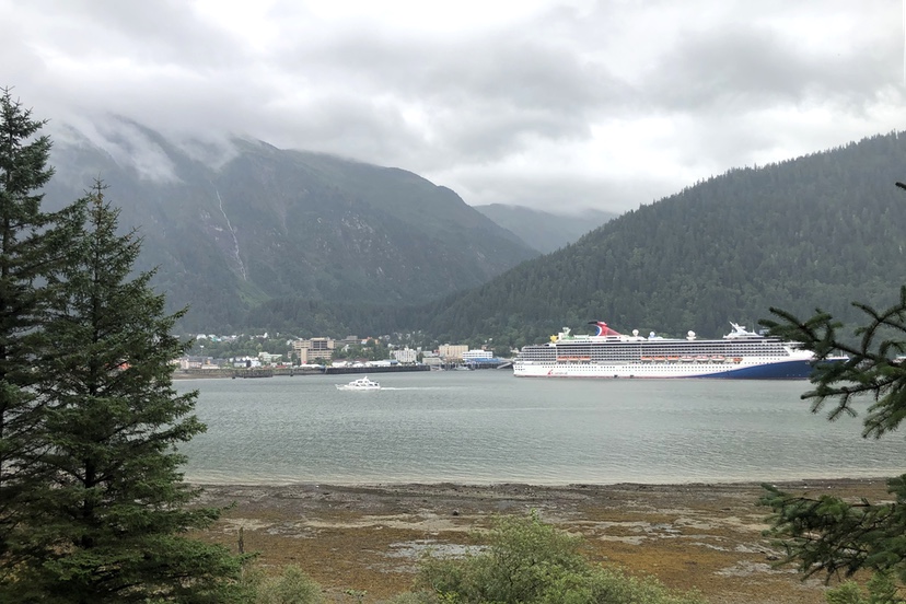
Here we see just such a cruise ship anchored adjacent to downtown Juneau, with a backdrop of Mt. Juneau (to the left) and Mt. Roberts (to the right) rising up 3,000 feet. (With the tops of the peaks hidden by clouds, as is so often the case.)
Juneau is located near the northeast corner of the Alexander Archipelago —one of the world’s largest archipelagos — a 35,000-sqaure-mile collection of large and small forested islands that were covered with a mile or two of ice during the most recent ice age, 10,000 years ago. The glaciers in the area, and the 1,500-square-mile Juneau Ice Field, are in. a sense, the last remaining remnants of that icy period.
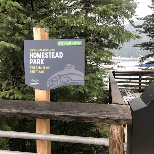
The sign at Homestead Park notes that you are situated on ‘Lingit Aani’.
That is, ‘Land of the Tlingit Indians’.
The Tlingit people lived in villages scattered throughout the Alexander Archipelago, and the villages were typically located along beaches or on major rivers. This made sense because the sea and waterways provided much of the food and also the transportation routes.
The villagers known as A’akw Kwáan gathered herring and flounder near the site that later became a rough-and-tumble gold mining camp. That camp spring up in 1880 and 1881 following the discovery of gold by Joe Juneau and Dick Harris in Gold Creek’.
The city of Juneau was not built upon a traditional village site. Rather, it was settled by gold miners and the various businesses that served gold miners. The Treadwell Mine quickly became one of the most technologically advanced mines of its day with 960 stamps grinding ore, and tunnels reaching as far as 2,400 feet below the surface and extending under the sea. Up to 2000 people worked at the mine before a collapse allowed the rising tide to flood the tunnels in 1917.
The nearby AJ Mine continued processing low-grade ore until 1944, when the economic conditions created by World War II rendered the mine unprofitable.
Reportedly, the Juneau mining district produced over 7 million ounces of gold.
I arrived in Juneau as a 19-year-old in 1971, believing that I would eventually end up on Kodiak Island, 650 miles farther north.
But I only had enough money to make it to Juneau, where my cousins lived. I got a job working for the recreation department, and when the U.S. government tried to draft me into the military, I applied successfully for ‘Conscientious Objector’ status and fulfilled my two-year obligation to work in ‘community service’ running recreation programs for at-risk youth.
By the end of those two years, I was in love with the Juneau community, and also, in love with my future wife, Clarissa Rizal Lampe, an artistically-inclined girl with a mixed Tlingit Indian – Filipino heritage.
We married in 1977 and were subsequently blessed with three children. I became a graphic artist and Clarissa grew into a nationally-renowned weaver of Tlingit ceremonial robes.
But the 1970s were a time of big changes in Alaska.
Oil had been discovered in the Prudhoe Bay oil field in 1968, but in order to build the necessary pipeline to get the oil to market, the U.S. Congress had to finally settle the question of Alaskan Native land claims.
Although the territory had been “purchased” from Russia in 1867 for seven million dollars, the land – 586,000 square miles — was occupied, not by Russians but by various indigenous tribes, none of whom were consulted about the so-called sale.
In 1959, the U.S. Congress accepted the territory as the 49th U.S. state, and section 4 of the Alaska Statehood Act provided that any existing Alaska Native land claims would be unaffected by statehood. That section of the Act preserved Native land claims until later settlement, but section 6 allowed for the state government to claim lands deemed ‘vacant’
In order to smooth the way for construction of the oil pipeline from Prudhoe Bay and the state’s ability to claim its own share of land, Congress went to work and negotiated the Alaska Native Claims Settlement Act, passing 44 million acres formerly classified as ‘federal lands’ into the control of 12 Native ‘corporations’.
The Act was signed by President Richard Nixon in December 1971.
The same year I first arrived in Alaska.
The effect on Alaska’s Native people was profound.
Read Part Three… tomorrow…