
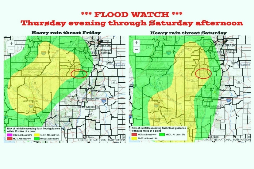
Maps courtesy PagosaWeather.org
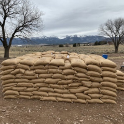
Archuleta County Public Works, Road and Bridge department, will be offering free sandbags to county residents ahead of expected rainfall across southwestern Colorado from October 10-22.
In preparation for potential flooding, Archuleta County is offering free sand and sandbags to help residents protect their homes and property.
Sandbag Pickup (Fill-Your-Own) Locations:
Arboles
95 County Road 973 (County Road and Bridge Shop)
Pagosa Springs
1122 Highway 84 (County Road and Bridge Yard)
Sandbags are free for Archuleta County residents and will be available beginning tomorrow, October 10.
Shovels will be available at each location, and County staff will be on hand to assist anyone needing help filling bags.
Residents in flood-prone areas are strongly encouraged to pick up sandbags early and take preventive measures to protect their property. Please continue to monitor local weather updates and take appropriate precautions during the upcoming weather event.
Additional information from PagosaWeather.org:
Thursday night through Sunday morning… Priscilla will visit.
Priscilla’s remnants will get entrained into the southwest flow ahead of a trough along the West Coast. The trough is expected to move through our area on Sunday.
Thursday night into Saturday evening precipitable water, a measure of the potential amount of water vapor available for precip, is 250% to 300% of average. This could result in significant rainfall in our area.
Thursday night through Sunday morning will be more active with widespread showers and a few embedded thunderstorms. Storms will produce brief periods of heavy rain, small hail, lightning, and gusty winds. The heaviest rain will fall Friday night and Saturday.
Snow… A subtropical feed means relatively warm air and mostly rain. Snow levels are around 12,600ft Wednesday afternoon, will jump to 14,000ft by Friday afternoon, and then drop back to around 12,000ft by sunrise on Sunday. Temps will hover around freezing so snow will struggle to accumulate.
Sunday afternoon through Monday morning… We’ll be between systems with partly to mostly cloudy skies and a few spotty showers, mostly over the mountains.
Monday afternoon into next Wednesday morning and possibly into next Friday… A slow-moving low-pressure system will wobble to our west and push rounds of storm energy and moisture through our area.
Right now the second half of Monday and Tuesday look pretty wet and then on and off scattered showers could persist through next Friday. Confidence is shaky on the details. Stay tuned.