
The rain tapered off during the day, Friday, October 23, following the flood peak — 15 feet — in the San Juan River, and similar peaks in its tributaries the previous evening, but the rivers and creeks in southwestern Colorado continued to rage through the day.
The public was urged to stay out of the river.
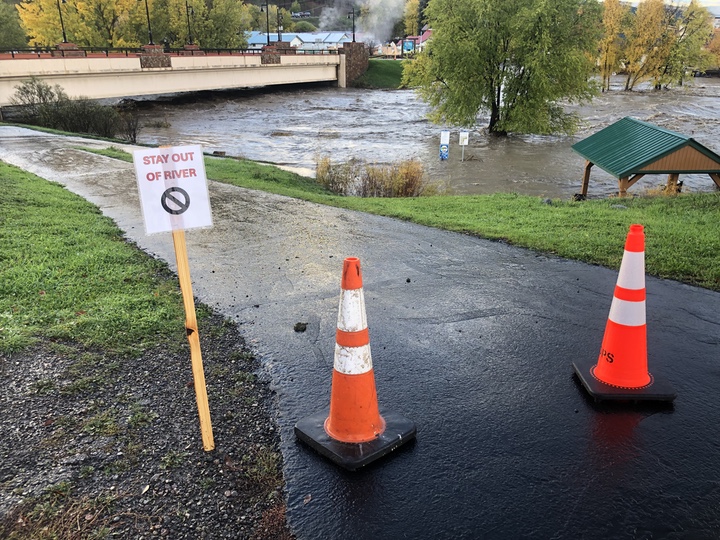
Thankfully, I did not see anyone swimming or rafting in the river as I walked through downtown late Friday afternoon.
My stroll began on North Fifth Street, around the corner from my house. The street had been closed off since very early on Friday morning, and the reason for the closure was obvious.
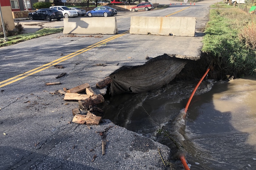
The culvert at McCabe Creek had failed to handle the flood volume. Historically, McCabe Creek is normally a mild-mannered trickle and causes no trouble for the single large culvert running under North Fifth Street. Such was not the case Thursday night leading into early Friday.
(The orange conduit holds a CenturyLink fiber optic cable which, to my knowledge, has never been put into service.)
A couple of blocks further downstream in the same north downtown neighborhood, a construction company had spent all summer installing three massive conduits where McCabe Creek passes under Florida Street. The (expensive?) project had successfully handled the flood waters.
Florida Street, however, doesn’t see near the amount of traffic that North Fifth Street sees.
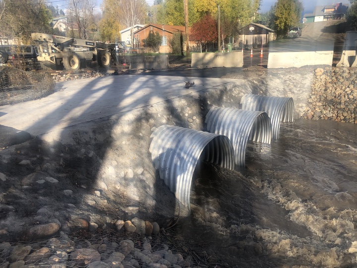
Clearly, the North Fifth Street culvert would have benefited from a similar upgrade, since it has to handle the same creek flows.
We can assume that the Fifth Street culvert will eventually be engineered and upgraded to a similar standard, with three large culverts… this time around. Just one of the millions of dollars of repairs that will be needed in the near future.
Continuing my walk through downtown neighborhoods, I stopped to shoot a short video of the river, near the Sixth Street pedestrian bridge. Most of the wetlands west of the Springs Resort and Town Hall were covered with muddy water.
I was unable to use the River Walk Trail because McCabe Creek had washed out an eight-foot section of the trail. So I headed up Sixth Street to the highway. (Sixth Street, going south, is closed to traffic due to erosion threatening the river bank.)
The sturdy new box culverts added by Colorado Department of Transportation (CDOT) about three years ago had handled McCabe Creek with no problem. I hate to think what might have happened to Highway 160 if the old, failing McCabe Creek culverts had not been replaced.
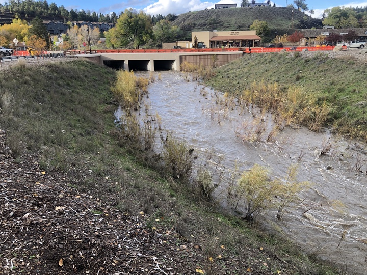
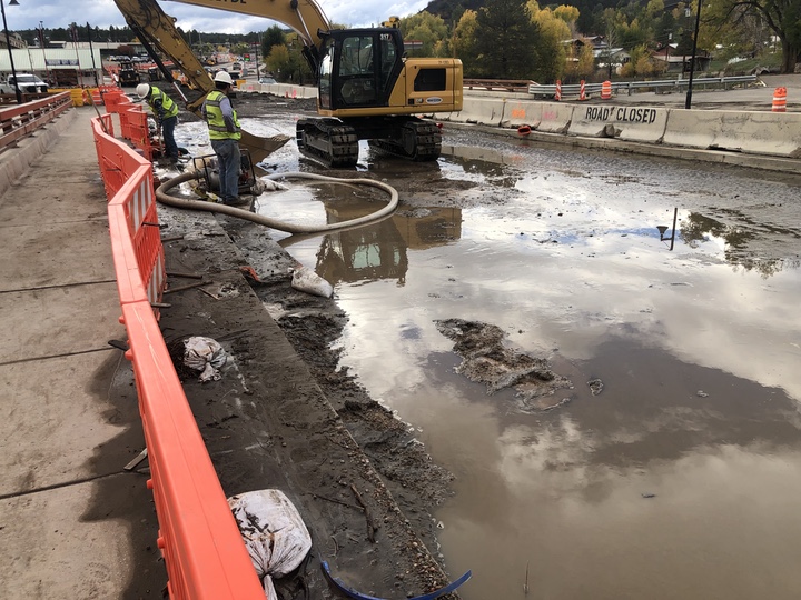
A crew of workers were installing pumps along the highway to drain the water in areas still unfinished by the two-year highway reconstruction project.
I cannot help but conclude that the project will still be ongoing next spring, despite of promises that it would be completed this year before winter sets in.
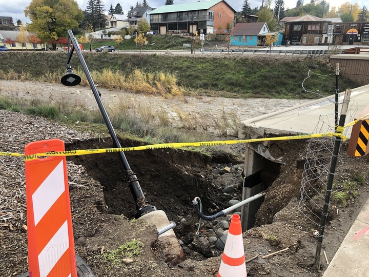
Although the McCabe Street bridge handled the creek successfully, the bridge design obviously did not account for the kind of rain event we saw on Thursday and Friday.
Bridge drainage had washed out an adjacent street light.
Traffic was relatively light, perhaps due to the closure of the highway just east of the Aspen Springs subdivision west of town. (Reportedly, traffic is now able to pass through that area, on an ‘alternating’ basis.)
The lake that had filled the athletic field at Town Park had dissipated, but Mary Fisher Park on the opposite side of the river was still under water.
Further east at the First Street bridge, the still-raging river had removed two sections of the Town sewer line that hung below the bridge. Here’s a short video.
Town crews had installed a hose along the bridge sidewalk to handle the sewage. Temporarily.
The now-defunct sewer pipeline under the bridge had been scheduled for redesign and replacement next year… or the following year?
On the north side of the First Street Bridge, the river had destroyed the protective rock work installed by Southwest River Engineering last spring, following the 2025 flood.
Following the two nearly-simultaneous flood events in October 2025, the Town government applied for disaster funding from the Federal Emergency Management Agency (FEMA) in the amount of about $5.7 million to address the flood damage. FEMA refused the request.
The Town did not cry over spilled milk, but instead submitted grant applications to other funding agencies, including the Natural Resources Conservation Service (NRCS) and Colorado Office of Emergency Management (OEM), and received funding in the amount of about $3.8 million for embankment stabilization and debris removal.
One of the embankments stabilized was adjacent to a Town-owned parcel at First Street where the Pagosa Springs History Museum rents a building and where the Town has been planning to install a new pedestrian bridge. The Town announced that, due to the 2025 flood damage, the bridge would have to be redesigned at a somewhat longer length.
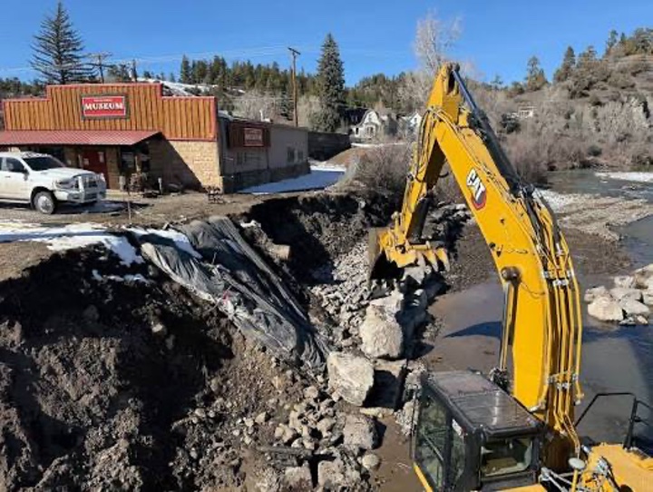
Here’s a photo of the stabilization project as it began last spring. I don’t know how much of the $3,8 million was spent on this particular project.
Below is a photo of the embankment on Friday afternoon.
Looks like we are pretty much back to “Return to GO do not collect $200.”
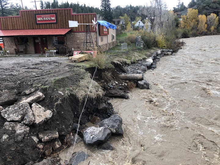
You might also note the blue tarp on the Museum roof. The rain and flood caused a power pole to fall over, damaging the roof. You can see the power pole in the top photo, and its absence on the lower photo.
Of course, downtown Pagosa Springs is not the only place in Archuleta County that saw flood damage. Every creek and stream and river on the county that passed under or along a roadway or near a home had the potential to cause damage. I’ve heard that the Lower Blanco neighborhood and the San Juan River Village neighborhood were hit particularly hard, as was Highway 151 heading down to Arboles.
Reportedly, traffic is now able to travel through Aspen Springs, on an alternating basis.
It will no doubt be several days, or weeks, before we hear about all the flood destruction.
From Pagosa Area Water and Sanitation District (PAWSD):
The following is update #2 regarding the impacts we are experiencing within the systems due to the flooding.
Mockingbird Lane: With the portion of road that has washed out exposing the water and wastewater lines, the water line has been turned off until staff can assess for possible damage. The property owners were notified with adequate notice to secure water prior to turning the water line off.
North Pagosa Blvd: A portion of the road has been washed out exposing a water line. Staff is looking at alternatives for securing water service.
2nd Street and Hermosa: We received pressure loss notifications early this morning. Staff is currently on site assessing the situation and has all customers’ water service back up and running. There is a water line at Apache Street that may have been compromised by the flooding, so we had to turn off the water to that area to protect the distribution system.
Vista Wastewater Treatment Plant was near capacity at times but is fully functional.
Snowball Water Treatment Plant and Hatcher Water Treatment Plant are fully functional.
The San Juan Water Treatment Plant [along Trujillo Road] is shut off as well as the San Juan River Intake for that plant.
Staff has been in contact with both CDPHE and the County’s health department regarding impacts from the flooding.
From the Town of Pagosa Springs:
The Town of Pagosa Springs has two important updates regarding evacuation orders and roadway access following this week’s flooding.
Evacuation Order Lifted: The mandatory evacuation order for Hermosa and San Juan streets has been lifted. These areas have returned to pre-evacuation status as a precaution. Residents should remain alert and prepared should conditions change.
US 160 Reopened: CDOT has confirmed that US Highway 160 is open between Pagosa Springs and Durango. Alternating one-way traffic is in place along the damaged section of highway in Aspen Springs. Please use caution, expect delays and follow traffic control instructions.
While conditions are improving, public safety remains our priority. The Town will continue to monitor conditions and provide updates as needed.
Thank you for your patience and cooperation as our community continues flood recovery efforts.
Bill Hudson began sharing his opinions in the Pagosa Daily Post in 2004 and can't seem to break the habit. He claims that, in Pagosa Springs, opinions are like pickup trucks: everybody has one.