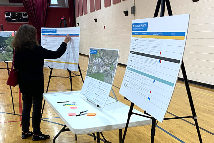
PHOTO: A citizen placing a ‘opinion dot’ during one of Alta Planning & Design’s public ‘input’ presentations of the East End Multimodal study. Photo courtesy Town of Pagosa Springs.
About five years ago, the Colorado Department of Transportation (CDOT) contracted with the Denver office of Wood Environment & Infrastructure Solutions, Inc., to study the Highway 160 corridor as it runs through downtown Pagosa Springs. (If you search thoroughly for “Wood Environment & Infrastructure Solutions, Inc.” you can find offices in Australia, United Arab Republic, Columbia, Chile, Italy… and here in the U.S. in California, Texas, Georgia and Florida. The global headquarters are in Aberdeen, Scotland. A big company.)
The resulting study was published in 2020, and amounted to 556 pages. You can download it from the Pagosa Springs Town website. (55 MB)
A more digestible document — a 15-page executive summary — is also available. (1 MB)
Of course, US Highway 160 runs through more than just downtown Pagosa Springs. It stretches from the western border of Archuleta County to the eastern border, splitting the county roughly into two geographic halves.
It does roughly the same thing through the urban core Pagosa Springs, creating a north half and a south half.
In 2018, CDOT determined that the downtown stretch of Highway 160 was in dire need of improvement, and the Wood study — two years and 556 pages later — came to this conclusion:
6. Conclusion
The proposed plan with the lane diet, pedestrian, and landscape improvements will operate acceptably for at least 20 years into the future. It will be safer for pedestrians and will be more inviting for tourists. While travel times may increase slightly, this is a downtown area where slower speeds are desirable from a business and pedestrian safety perspective, so the slower speeds are outweighed by the benefits resulting from the traffic calming.
6.1 Plan Revisions
The US 160 Reconstruction plans are shelved awaiting funding.
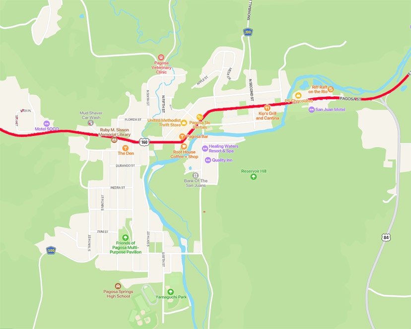
As we can see on the map above, the majority of the residential and commercial development in the historical downtown area took place to the west of the First Street Bridge, where the San Juan River passes under Highway 160.
But we also see a bit of commercial development to the east of the First Street Bridge. The ‘East End’.
We might also notice that the map offers another name for Highway 160, as it enters the downtown on the east end. “Pagosa St.”
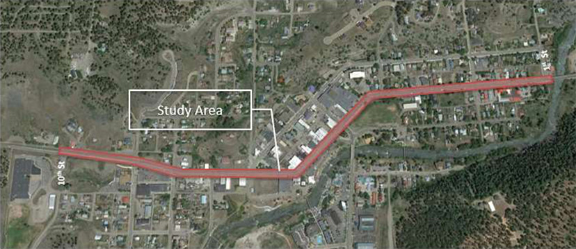
When they defined the portion of ‘Pagosa Street’ in need of a ‘corridor study’, CDOT totally ignored the ‘East End’. The study area extended between First Street on the east and 10th Street on the west.
Once again, the East End was treated as if it’s not an integral part of Pagosa’s downtown — for whatever reason. Not worthy of serious consideration?
Because it’s the only part of ‘Pagosa Street’ with frontage roads on both sides of the highway? Some other reason?
The Wood study does not explain (as far as I can tell) why the East End was left out of the study area. But the absence of the East End, in that study, might help explain why the Town later contracted with Alta Planning & Design for a $200,000 study of the transportation challenges east of the First Street Bridge. That would be, the ‘Multimodal’ challenges.
Both the 2020 Wood study (First Street to 10th Street) and the 2022 Alta study (east of First Street) focused on a number of safety and cultural issues: vehicle movement, pedestrian and bicycle movement, parking issues, landscaping.
Two considerations largely absent from the Wood study, while being rather prominent in the Alta study, were ‘tourism’ and ‘recreation’.
One could even make the case that the Wood study was primarily concerned with transportation, while the Alta study was primarily concerned with recreation.
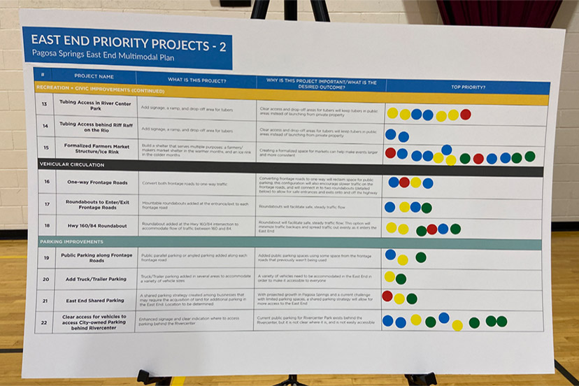
Here’s an example of what I mean. During the Third Phase of the plan development, Alta and the Town staff had sharpened their focus, and asked the public to weigh in on 22 ‘priority projects’.
The most popular project, among the participants, was a ‘Pedestrian Bridge’ connecting First Street to the River Center parking lot, over the San Juan River. This bridge would serve people accessing the East End on foot or by bicycle.
I suspect, if anyone had ever taken a survey of the number of bicycles accessing the East End annually for commercial purposes, the number would be less than ten. But the number of recreational cyclists entering the East End to ride the Reservoir Hill trail each year would probably number in the dozens.
As far as pedestrians entering the East End, I suspect 90% of the annual foot traffic is tourists with rented inner tubes, putting in at River Center Park. Considering that these tourists are dressed in swim suits and have every intention of floating down a river, I would guess that relatively few of them end up patronizing the East End businesses.
I’m not the only person who sees the proposed East End priorities as linked to recreation and tourism. At the Phase Three public input meeting, these are the ‘priority projects’ to which citizens gave the highest marks:
1. Pedestrian Bridge at 1st Street
2. Formalized Farmers Market/Ice Rink
3. Clear access to Town-owned parking near River Center Park
4. Riverwalk extension heading south under Highway 160 [away from the East End]
5. Enlargement of River Center Park and add Boat Ramp
6. Tubing Access in River Center Park
These priorities, above, might have little impact on the ‘brick-and-mortar’ commercial activity in the East End… but they might further Pagosa’s reputation as a tourist destination and recreational wonderland.
So we could ask ourselves, is this a ‘Multimodal Transportation’ plan… or is it actually an ‘Enhanced Recreation’ plan?
And if that’s the case, who ought to pay for the enhancements?
The tourists, perhaps?


