
By Eric Davidson
Aspen Springs has often been the butt of jokes or ridicule by Pagosa residents… Much of it well-earned.
However, the two recent flooding events helped to clarify just how much Aspen Springs is the “red-headed step child” of Archuleta County, yet remains full of caring, sacrificing, and considerate people who banded together to come out of these storms a little more ragged, but stronger as a community.
Last summer when we had one of the County Commissioners’ open forums in Ute park, folks joked that the last time the Commissioners were in Aspen Springs was 2009 at the dedication of Ute park, and that was with a police escort! We have a “wild west” reputation mostly due to the remoteness of the area, but also due in part to the can-do attitude that permeates rural America.
Not many people realize Aspen Springs Metropolitan District (ASMD) is the largest residential subdivision in the U.S. At just over 9.7 square miles (larger than Durango at 6.5 sq. mi.), the 67 miles of roads are the primary focus of the district. After the floods, every single one of those miles needs more gravel and restoration work.
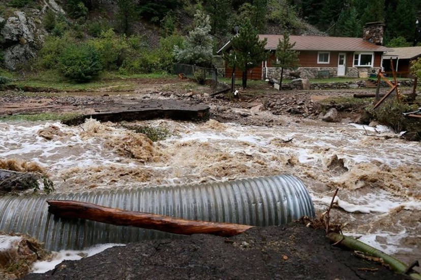
The mill rate for property taxes in the district hasn’t changed since 1994, and we operate on a shoestring budget. The massive damage from the first “100-year flood” and the subsequent 5-day recovery alone cost the district $125,000… and all that gravel and effort washed away during the second, “200-year flood”. We will have a state disaster assessment team from CDPS visiting us on Wednesday to put eyeballs on the destruction and hopefully steer relief/recovery funds to us quickly.
Our ‘burn rate’ of funds is incredible and we are at the end of the fiscal year – the bank vault is getting pretty bare this time of year, and we don’t have the ability to deficit spend one dime.
One of the largest contributors to the flood damage is unfortunately the infrastructure of the Pagosa Lakes area. What used to be a large drainage zone with several small seasonal ponds that could fill during heavy rains has been changed. Today, lakes all stay within a tight zone of depth so that the property owners can enjoy year-round lakeside homes. It greatly improves property values as well as quality of life. Unfortunately, those benefits come at a price and Aspen Springs paid that price dearly during both flood events. Even when we knew a second and larger flood was coming, no pre-planned lowering of the lakes occurred. The lakes were simply wide rivers, dumping every drop entering each lake with remarkable efficiency downstream. The greatest flood damage in the Pagosa Lakes area is where one lake dumped into another.
At the outlet of all that flow was Martinez Canyon and the creek running through it. Stollsteimer Creek was going to experience elevated flows, but one only need look at the confluence of Stollsteimer and Martinez creeks. That area has never seen anywhere close to that flow rate. The culverts under Hwy 160 were engineered for 100-year floods, but failed to come anywhere close to handling the flow of Martinez Creek during either event.
Two critical bridges into Aspen Springs – Oak Ridge and Hurt – were over-topped during both floods as well, with Oak Ridge taking impacts from two other bridges and a large deck. County Road 700 – Cat Creek bridge was over-topped as well, threatening the only means of access to the outside world for thousands of residents of Aspen Springs units 3, 4, 5, and 6. Most of our initial recovery work has been focused on those bridges and their approaches.
The evidence of this county infrastructure complaint can be summed up in one photograph: a lake carp lying on top of Oak Ridge bridge. This poor beat-up fish didn’t come from some deep spot on Stollsteimer. It was literally flushed out of a lake and into the canyon, eventually to come to rest atop the bridge in Aspen Springs.
Unfortunately, those bridge and approach efforts have detracted from the ability to focus on the roads throughout the rest of the district. Whole roads have been washed out along a full quarter mile of their length. Residents have been stranded for over a week – but like most Aspen Springers, they have very stiff spines and are capable of withstanding periods of privation.
However, the many issues we are dealing with doesn’t mean Aspen Springs needs to be at the back of the line (where we are used to standing.) The level of destruction is rivaled only by the San Juan flooding, and the Arboles area where the Piedra River and Stollsteimer Creek come together. We have earned a prime spot at the recovery fund trough, and we are working hard to make that happen by working with local and state officials.
In the meantime, please thank CDOT personnel for opening up Hwy 160 to Pagosa for us. Also, thank the ASMD Public Works folks for the hard work they are doing, and ‘give them a brake’ – slow down and give them the right-of-way, as they have a very important job to do!
Eric Davidson is President of the Aspen Springs Metro District.
The Pagosa Daily Post welcomes submissions, photos, letters and videos from people who love, and care about, Pagosa Springs, Colorado. More information available at 970-903-2673 or pagosadailypost@gmail.com