
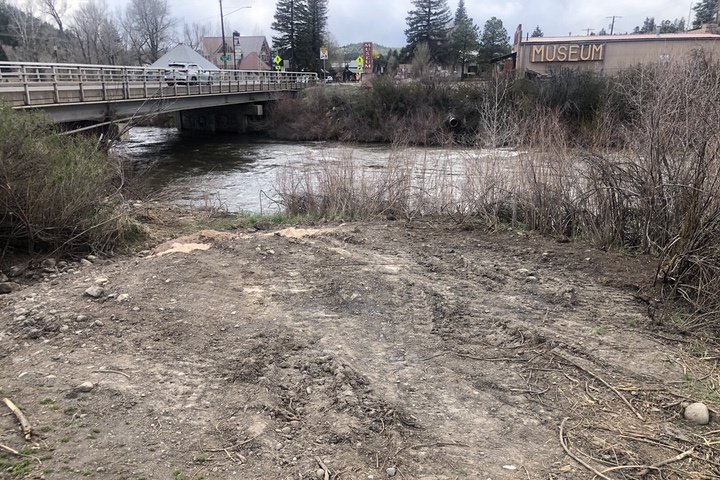
Photo: Disturbed soils near the site of a proposed pedestrian bridge.
“I think this could be one of the most used bridges once it’s constructed,” he said, adding that it will provide more connectivity throughout the downtown area.
— Town of Pagosa Springs Community Development Director James Dickhoff, speaking at the April 18 Town Council meeting, as quoted by reporter Clayton Chaney in the weekly Pagosa Springs SUN.
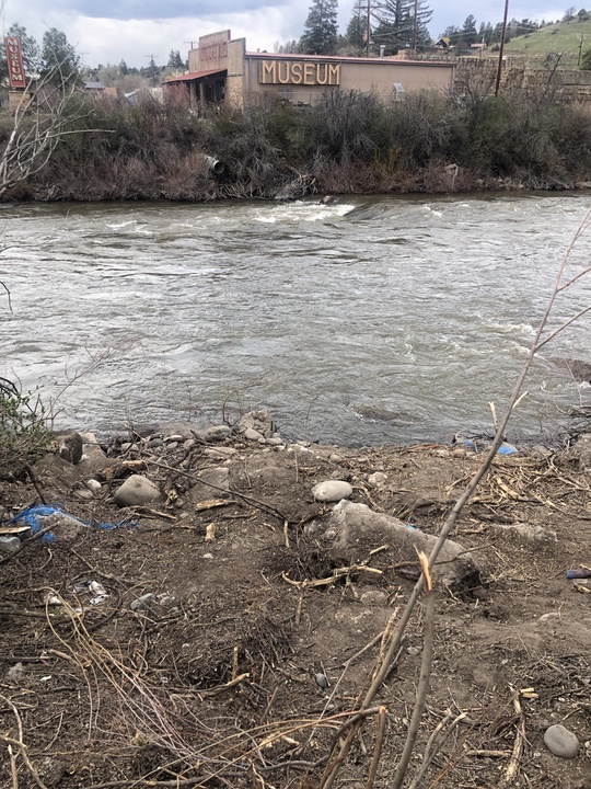
Apparently, one of the bigger problems facing the Town government, in its efforts to build a 165-foot pedestrian bridge across the San Juan River — connecting our summer-season-only History Museum… and the historical downtown in general… to the Malt Shoppe and the rest of the East End commercial district — is the fact that the Town has no idea where the pertinent underground water lines are located.
We wouldn’t want to design a new bridge, and later discover that we have located the footings right on top of existing water lines.
Disclosure: I currently serve as a volunteer on the Pagosa Area Water and Sanitation District (PAWSD) Board, but this editorial reflects only my own opinions, and not necessarily the opinions of the PAWSD Board as a whole.
A little bit of history. The drinking water system that serves downtown Pagosa Springs was operated for many years by the Archuleta Water Company.
In the early 1970s, the PAWSD district was formed to service a planned 21-square-mile suburban development west of downtown, now known as Pagosa Lakes. In 1992, PAWSD took over the operations of the downtown water system, and also the operations of the Archuleta Water Company, which also served certain areas outside of downtown. That created a water district with about 300 miles of water mains… some new, some old.
Prior to the 1970s, Pagosa Springs could be described as a poor, agriculture-based community — with an economy based largely on ranching and lumber mills. The location of underground infrastructure was probably based, not on a thorough mapping system, but rather, on the memory of water district employees… employees who have long since passed away, taking their memories with them.
So the Town and PAWSD often face a clever challenge. “Find the water pipes.”
When I visited the site of the proposed pedestrian bridge last week, I found an area on the river bank where the earth had been disturbed, and the vegetation — mostly willow shrubs — was gone.
I would assume someone had been looking for underground water lines. And perhaps found them?
In Part One, I shared a bit of information about the Community Vision Council — a private group selected by billionaire developer David Brown to endorse his ideas about “preserving, renewing and revitalizing” our historical downtown area. Mr. Brown had recently moved his family to the Bootjack Ranch, in Mineral County, just over the border from Archuleta County along the West Fork of the San Juan. He’d grown his net worth in Silicon Valley, buying up agricultural properties and “renewing” them into sites for high-tech office buildings.
If you think about those terms carefully, you might come to the conclusion that “preserving” a community — in terms of its architecture, landscape, and economy — is not necessarily the same as “renewing” it.
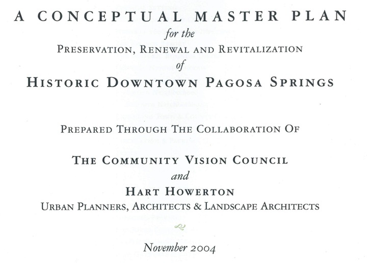
The ‘East End’ commercial district might, or might not, be considered part of the ‘historical downtown’. The area does appear, briefly, in the “Conceptual Master Plan for the Preservation, Renewal and Revitalization of Historic Downtown Pagosa Springs”…
… but the 46-page Plan focuses its attention mainly on the CBD. The “Central Business District”.
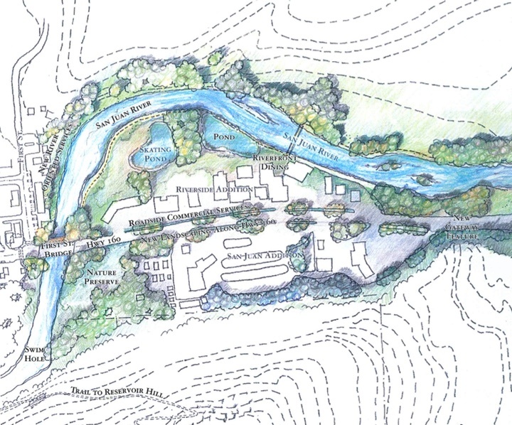
The East End commercial area (labeled “Eastern Approach Zone”) rates three short paragraphs, plus a drawing showing a lot more mature trees than currently exist there.
We note that, since the production of the Conceptual Master Plan in 2004, the Town planners have taken steps to better include the East End in the Town government’s planning routines.
Specifically, the Town obtained a grant to pay consultants Alta Planning & Design (and others) to write up a 179-page plan for the East End. This plan makes many. many suggestions for improving parking and accessibility for the East End, without putting a price tag on the many, many suggestions.
Might we assume that the businesses in this area would ultimately pay for these improvements? (The area has no residential housing to speak of, although it did once include an RV park, back before RVs were considered a type of residential housing.)
Or might we assume the taxpayers will foot the bill?
In the case of the proposed pedestrian bridge at the Pagosa Springs History Museum, it appears the taxpayers are the donors of choice.
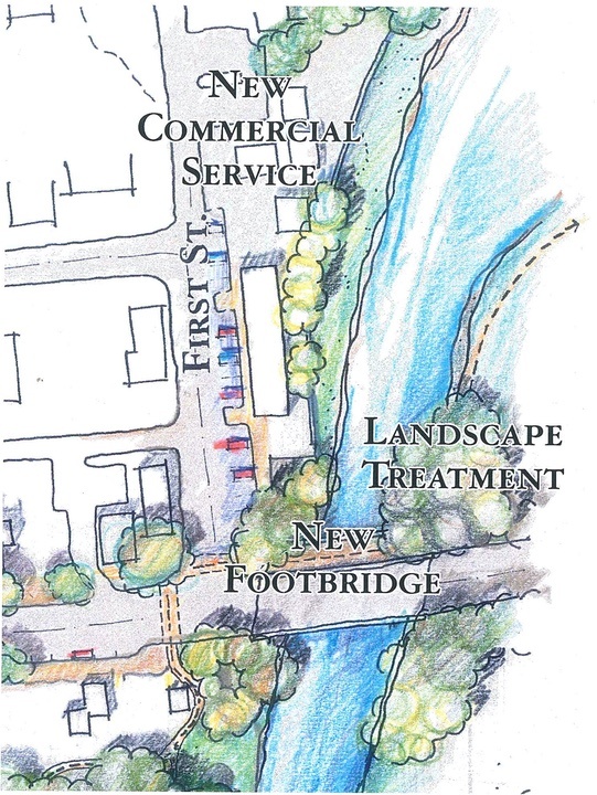
I mentioned in Part One that this pedestrian bridge was suggested in the 2004 “Conceptual Master Plan for the Preservation, Renewal and Revitalization of Historic Downtown Pagosa Springs”… but the drawing also suggests that the History Museum may have been relocated to somewhere else? (Let’s be honest, here. The Museum building and site is not the most attractive in downtown Pagosa.)
And in the drawing, the first block of First Street has become more attractive to parked cars accessing a “New Commercial Service” area.
It also shows “Landscape Treatment” right about where someone recent tore up the willow shrubs on the east side of the proposed bridge location.
We began this installment with a quote from Town Community Development Director James Dickhoff, speaking at the April 18 Town Council meeting. Mr. Dickhoff was recommending that the First Street pedestrian bridge be wider than the existing pedestrian bridges downtown. Those existing bridges are about 7 feet wide, but Mr. Dickhoff would like the proposed First Street bridge to be 10 feet wide, to accommodate bicycles passing in opposite directions.
Mr. Dickhoff:
“I think this could be one of the most used bridges once it’s constructed, because we’ve got connectivity. It’s not only connecting along our River Walk, but it also provides connection for our sidewalk network, across the river. So we actually anticipate a little more traffic on this bridge than on some of our other pedestrian bridges. And I think what we see, a lot of times, is people just enjoying hanging out on the bridge, watching the the river users and what not. So we thought a 10-foot wide bridge would be a reasonable consideration…”
Well, now… how ‘reasonable’ might that consideration be?