
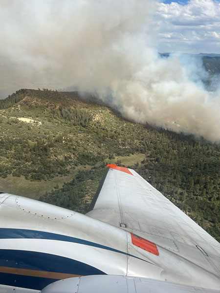
PHOTO: Chris Mountain Fire, June 28, 2023, courtesy Inciweb.
The Chris Mountain Fire on the San Juan National Forest Pagosa Ranger District was reported on June 28, at 3:00pm.
Archuleta County has issued mandatory evacuations for all of Forest Service Road 628.
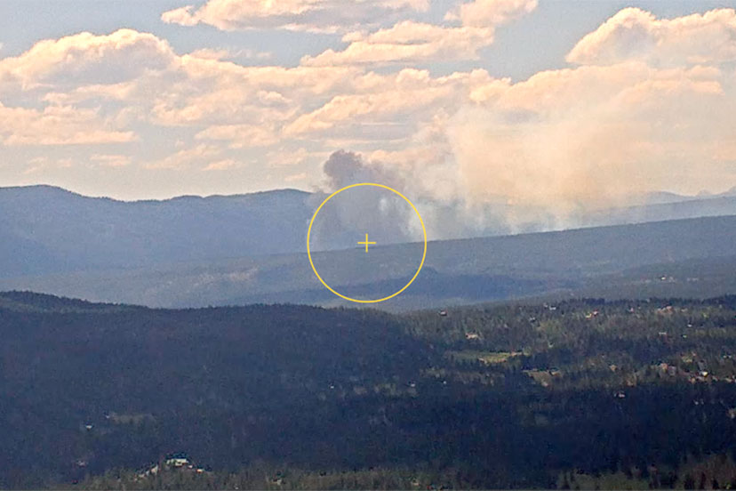
The 120-acre fire is burning on Chris Mountain, located approximately 12 miles west of Pagosa Springs, north of Highway 160. Archuleta County has issued mandatory evacuations for Forest Road 628, effective June 28th, 2023. To sign up for emergency notifications, visit the Archuleta County Emergency Operations website.
Official incident information can also be found at https://inciweb.nwcg.gov/incident-information/cosjf-chris-mountain-fire.
The Chris Mountain Fire is burning in Ponderosa pine and timber. Fire behavior in the afternoon was crowning and spotting with 50 to 100-foot flame lengths. The local San Juan National Forest Type 3 Incident Management Team will take command of the fire today, Thursday, June 29.
Smoke from the Chris Mountain will be visible to surrounding communities for the duration of the fire. Chris Mountain Fire smoke may affect your health. For more information, please go to https://www.colorado.gov/pacific/cdphe/wood-smoke-and-health
The San Juan National Forest will continue to provide additional incident updates as needed.
For questions, please contact the San Juan National Forest Public Information Officer, Lorena Williams, at 970-422-2939.
From Wildfire Adapted Partnership:
Monday night’s storm brought a lot of lightning and very little precipitation. There have been quite a few fire starts in the area and smoke coming from multiple directions.
Two new fire starts are growing and of serious concern.
Chris Mountain Fire, west side of Chris Mountain, 12 miles west of Pagosa Springs, 120 acres
Mandatory Evacuation orders for USFS 628 Rd. to CR 146 (Turkey Springs Rd.)
Coal Mine Fire, 2 miles west of Trujillo Rd. & Estates Circle Rd., 180 acres
Pre-evacuation orders for residents between mile markers 15 and 18.
Vahala Fire, near Treasure Falls, 0.1 acre
Six Horse Canyon Fire, 9 miles south of Pagosa Springs, 1.5 acres, growth suppressed
Piedra Peak Fire, northwest of Navajo Lake State Park, 0.1 acre
Sandoval Fire, northeast of Navajo Lake State Park, 1 acre
West Sandoval Fire, northeast of Navajo Lake State Park, 1 acre
Arkansas Loop Fire, 9 miles southwest of Ignacio, 86 acres
Northern New Mexico also has wildfires burning:
Broken Butte Fire, near US 64 & US 84 junction, 0.1 acre
Middle Mesa Fire, west of Navajo Lake State Park, 4 acres
Ditch Canyon Fire, west of Navajo Lake State Park, 0.1 acres
Trail Canyon Fire, west of Navajo Lake, 3 miles from CO border, 15 acres
Evacuation Information
Ready Set Go, https://www.iafc.org/docs/default-source/pdf/rsg-eag.pdf pages 8,9 & 10