

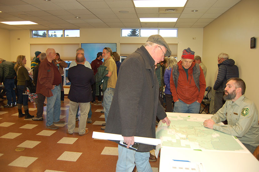
PHOTO: Attendees at the U.S. Forest Service open house ask questions about the development of a potential gravel mining and crushing operation just north of the San Juan River Village subdivision, on February 2, 2023.
The boundary line of the Jackson Mountain ‘Landscape Project’ delineates an area of about 10,000 acres, but the actual area that seems ripe for ‘landscaping’ on the San Juan National Forest maps measures somewhat less than 10,000 acres. The two biggest projects are the “fuels management” (removing brush and understory trees, and logging certain areas, potentially 3,000 acres) and development of a 40-mile single-track mountain biking/hiking trail system that covers about 4,500 acres.
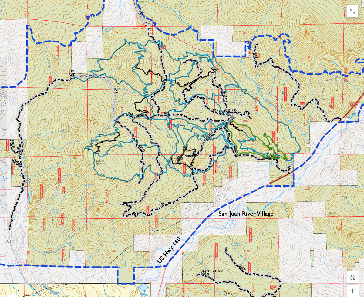
Here, again, is the map of potential trails we shared yesterday in Part One. Click the map for a larger view.
Or visit the Jackson Mountain StoryMap page, here, for an even larger view, and more information.
The areas that might be subject to “fuels management” are shown in this map. Click to enlarge.
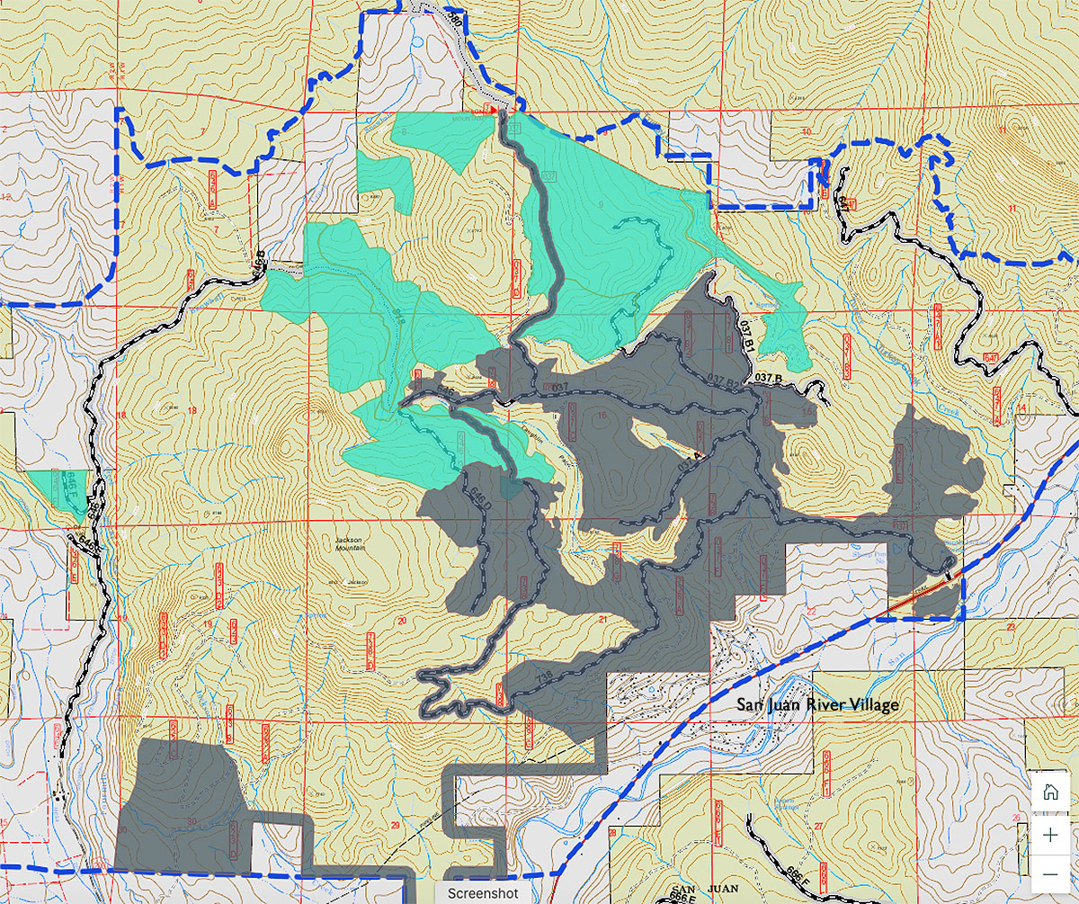
As we can see, the proposed “fuels management” is focused immediately north of the San Juan River Village subdivision. This decision would obviously align with recent Forest Service policies that aim to reduce potential fires danger especially in areas where urban and suburban neighborhoods have spread into the (highly flammable) forest.
The “fuels management” area is already served by old logging roads… another reason for choosing this project area, perhaps.
A much smaller area has been designated as a future gravel mining and crushing operation. Potentially.
This 30-acre area includes about 13 acres of rock suitable for road maintenance, and would — if approved — be a non-commercial operation that serves only the Archuleta County government and the U.S. Forest Service. At least, that’s the plan at the moment.
Not a terribly popular plan, apparently.
At the Archuleta Board of County Commissioner’s work session yesterday morning, Commissioner Warren Brown noted that he’d attended the Forest Service open house on February 2, and had “the opportunity to speak with a number of people there. And I found… one supporter of the gravel pit. But the remainder were against it, at that location.
“There were multiple supporters of having the [biking and hiking] trails there.
“And my statement to the folks that I spoke to there, was that I’m not married to a gravel pit at this location, but I’m married to a gravel pit somewhere in Archuleta County.”
We’ll talk more about the gravel pit conversation that took place at yesterday’s BOCC meeting, in Part Three.
But first, let’s take a look at the proposed gravel mining and crushing operation that might eventually be approved for a location with the Jackson Mountain Landscape Project area, located about 700 yards north of some properties located in the San Juan River Village subdivision.
A subdivision located within a so-called “WUI”.
A “Wildland-Urban Interface”. A subdivision at risk of being burnt to the ground, should an uncontrollable wildfire break out in the Jackson Mountain forest. More about the WUI in Part Four.
But let’s start with the rocks. A sizable mineral deposit located close to an existing road system, reportedly of a suitable hardness to hold up to the traffic on county roads. Beautifully encrusted with lichens.
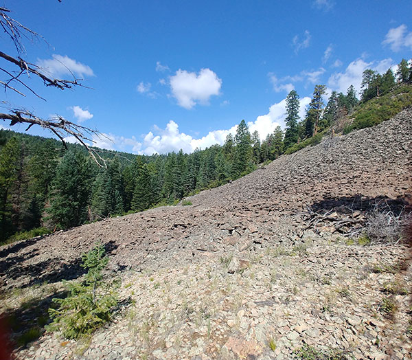
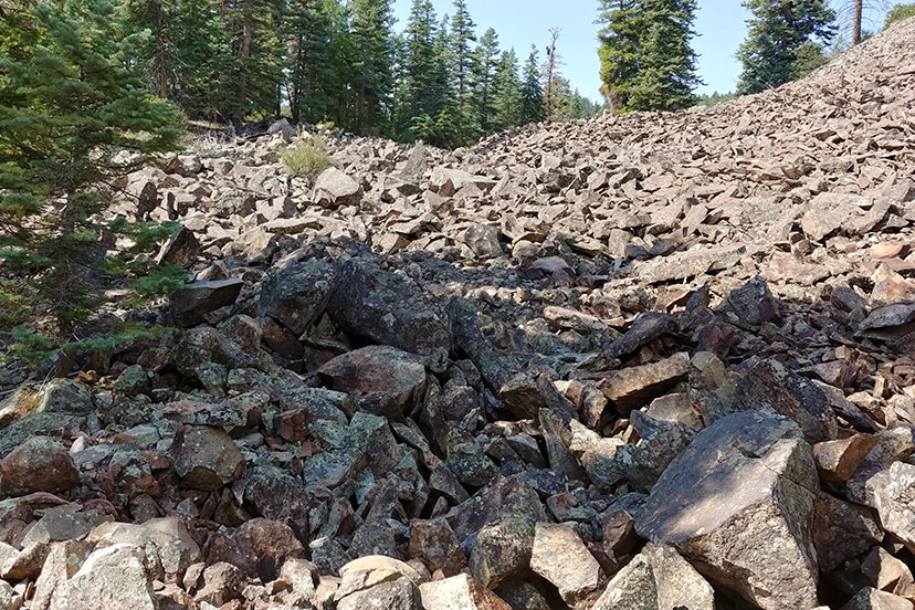
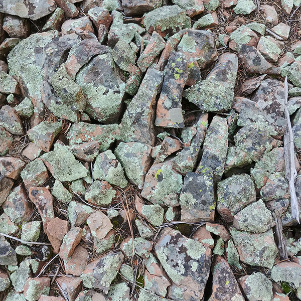
This is not the only collection of potential gravel material in Archuleta County, but it might amount to 20 to 30 years’ worth of gravel material. No one is sure, yet, how deep the pile might be.
You can see the location in relation to the San Juan River Village subdivision, in the map below.

It’s not an ideal gravel site, perhaps. For a couple of reasons.
Many gravel sites provide suitable rock already mixed with clay soils, but this site might not. To be used most effectively on roads, gravel should be mixed with about 10% clay, to help bind the gravel to the road surface.
The gravel located at the proposed Two Rivers site, down Trujillo Road, for example, existed in a deposit of mixed rock and clay, as shown in the following photo from 2016. Lee and Jac Constant had been working with Durango-based C & J Gravel to present a proposal to the Archuleta BOCC, to mine and crush the rock on the Constant’s 320-acre homestead. The site was described by at least one commentator as a “superior” source of gravel.
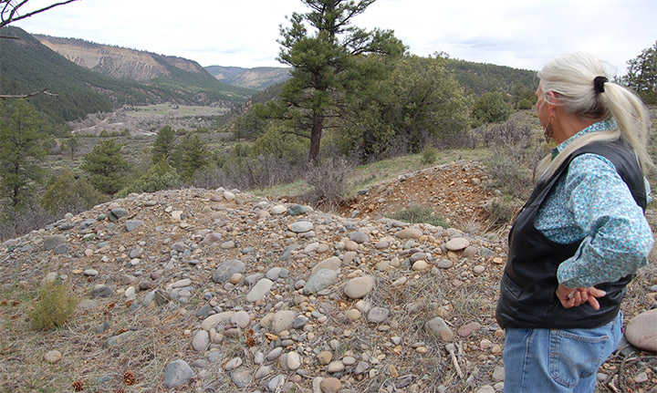
Following the required public hearing, the BOCC ultimately rejected the mining permit on Trujillo Road, based primarily on the fact that gravel trucks would be transporting the material through one or more residential subdivisions. The impact on the subdivision gravel roads, and the generated noise and dust, were the primary objections heard from county residents.
You can read about the legal problems faced by the Constants in this Daily Post article from 2016.
The rock in the Jackson Mountain deposit might be less than ideal, if it doesn’t come with an accompaniment of clay soil.
It also might be less than ideal, if the neighboring property owners become organized to oppose the project.
The Forest Service is currently conducting a NEPA review process and is accepting public comment through February 23. The National Environmental Policy Act was signed into law on January 1, 1970 by President Richard Nixon, requiring federal agencies to assess the environmental effects of their proposed actions prior to making decisions. No Forest Service decision has yet been made (as far as we know) about the gravel pit.
To submit comments on the project, go to this website and click on “Comment/Object on Project”.
Hardcopy input can be mailed via United States Postal Service (USPS) or sent via courier (UPS/FedEx) to:
Pagosa Ranger District – Jackson Mountain project
180 Pagosa Street
PO Box 310
Pagosa Springs, CO 81147
For more information about the Jackson Mountain Landscape Project, you can contact:
- Recreation – Paul Blackman, (970) 264-1505, or paul.blackman@usda.gov
- Vegetation/Fuels Management – Adam Tlachac, (970) 264-1513, or adam.tlachac@usda.gov
- Gravel Pit – Jamie Blair, (970) 560-6630, or james.blair2@usda.gov
Tomorrow, we’ll listen to a February 7 discussion between the Archuleta commissioners, on the subject of gravel.