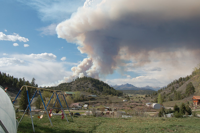
As soon as I walked in the door at 3pm — after attending the Tuesday, May 17 meeting of the Archuleta Board of County Commissioners — my son-in-law Chris asked me if I’d seen the fire.
“What fire?”
He led me out the back door, and pointed out past the kids’ swing set, at the distant pine forest. Except it didn’t look all that distant. In fact, it looked a bit too close, knowing how quickly a wildfire can move, given enough wind.
But frankly, for the moment, it didn’t look too serious.
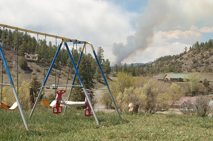
“Well,” I said to Chris, “Looks like I’m going to need my camera.”
“The firetrucks went up Four Mile Road,” Chris offered. I told him I was going to try Cemetery Road.
As I drove, I took notice of the wind, and the wind direction, and sensed only a light, occasional breeze. That was a good omen, although I’ve heard that a wildfire can create its own wind.
A couple of miles up Cemetery, I stopped for a photo. Judging by the smoke, the wind was coming from the southwest, meaning the fire would likely be moving in a northeasterly direction.
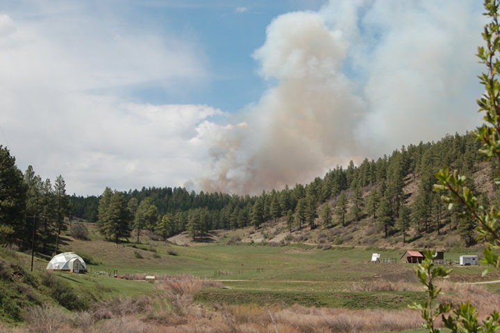
Back in town, I stopped in at the Archuleta County Administration Offices and learned that I could keep up with developments via Facebook, on the San Juan National Forest page.
Here’s what had been posted there at about 2:45pm.
Resources are on scene of a 1-2-acre fire burning 4.75 miles northwest of the Pagosa Springs airport off Plumtaw Road. The Plumtaw Fire is burning in ponderosa pine, gambel oak, and mixed conifer forest. 3 large air tankers and a heavy helicopter are en route and air attack is on scene. We will continue to provide updates on this page as we have them.
Through my camera lens, the fire had looked larger than “1-2 acres.”
That Facebook notice was followed by a posting by Mineral County Emergency Management:
A PRE-EVACUATION NOTICE HAS BEEN ISSUED for Lost Valley of the San Juans, located on the 4 Mile Road in Mineral County. The #PlumtawFire is an evolving wildfire, burning approximately 1 mile from the pre-evacuation area and 4.75 miles northwest of Pagosa Springs airport. Multiple air and ground resources are on scene.
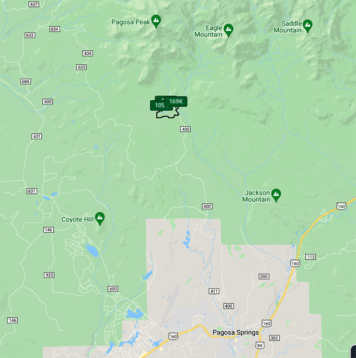
I had no idea that the Lost Valley of the San Juans was in Mineral County. In fact, I had to look at a map to confirm what I’d read on Facebook. Yes, the Lost Valley of the San Juans seems to be in Mineral County. (Why do I not always believe government officials? Shame on me.)
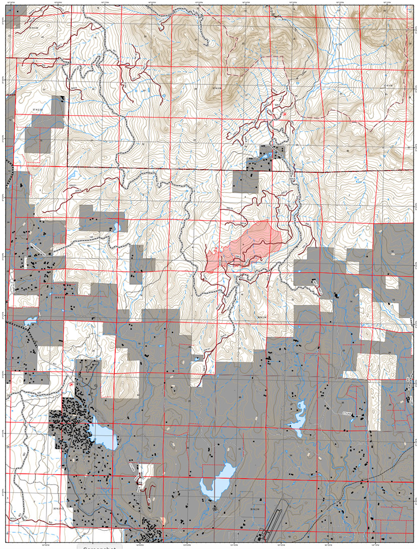
Here’s a map I found on a real estate website, indicating that there are three parcels currently for sale, in the Lost Valley subdivision… shown bounded by a black outline.
At about 4:30, the San Juan National Forest had shared a new message posted by the Mineral County Emergency Management.
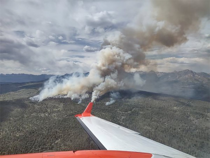
The roughly 50-70-acre #PlumtawFire is burning 4.75 miles northwest of Pagosa Springs airport, and is north of Plumtaw Road. An EVACUATION NOTICE has now been issued for the Lost Valley of the San Juans neighborhood. Contact Archuleta County Dispatch for more information on evacuations. Five large air tankers and multiple helicopters are working the fire, in addition to ground resources from multiple partner agencies.
The fire began at roughly 1pm on May 17 and the cause is under investigation.
The post included this photo.
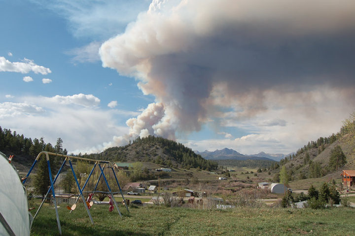
By 5pm, the view from our back yard had changed.
At 6:30 I was sitting in the Pagosa Springs Middle School library with a dozen people — mostly school staff — waiting for the School Board to finish a closed-door executive session concerning the hiring of a new superintendent… and someone announced that the fire was now over 450 acres.
An Emergency Operations Call Center had been set up for evacuation information: (970) 422-7084.
At 8:10pm, the School Board was still locked in a private room, and only a half dozen of us were still waiting to hear who will be the next District Superintendent. Presumably the fire was continuing to burn. When the School Board arrived, finally, after a two-plus-hour executive session, they made no announcement about a hiring choice, but merely scheduled yet another meeting, next Tuesday.
Meanwhile, the San Juan National Forest had emailed out an announcement, at 8:04pm. The fire was estimated at over 600 acres.
The Plumtaw Fire is burning 7 miles north of Pagosa Springs, 2 miles west of the intersections of Plumtaw and Fourmile Roads. An evacuation notice has been issued for the Lost Valley of the San Juans, located in Mineral County.
The Plumtaw Fire was most recently mapped at over 600 acres and growing. Multiple Large Air Tankers (LATs), one lead plane, an air attack platform, and 3 helicopters have worked this afternoon and evening with ground crews to suppress the fire. A Type 3 Incident Management Team will be taking command of the incident, and a Complex Incident Management Team (formerly referred to as a Type I or II Team) has been ordered along with additional resources and crews. Resources from multiple state, federal, county, and municipal agencies are working in close coordination.
The fire area will be closed to the public, including Fourmile Road (NFSR 645) at the forest boundary, and Plumtaw Road (NFSR 634) from the junction of McManus Road (NFSR 633). This closure includes Fourmile Falls Trailhead.
The Forest Service was notified about the fire at approximately 1pm on May 17 and is burning in Ponderosa pine, Gambel oak, and mixed conifer. The cause of the fire is under investigation.
The San Juan National Forest is planning to enter Stage 1 Fire Restrictions no later than May 25. More information is to come this week on fire restriction implementation.
The little black squares are homes.
At 9:00pm, a person with an unfamiliar phone number left a voice mail.
“Hello, Bill… I’m wondering if you’ve heard anything about the local town and county government calling Governor Polis for help? We’re going to get high winds tomorrow — 40 mile an hour gusts — and it’s going to be hot. I’m wondering if anyone has bothered to call him?
“We need more help here, firefighter-wise and equipment-wise…”
Good question.

