
During a recent meeting of the Pagosa Springs Planning Commission, the volunteer commissioners briefly debated the subject of “gated communities”.
The discussion sparked my interest in gated communities, and especially whether a small, rural town like Pagosa Springs would find its essential character forever changed by the allowance of gated communities.
Most of the people who cite “Pagosa Springs” as their hometown technically live outside the incorporated Town boundaries, where property rights are regulated by the Archuleta County government and often by a property owners association as well. Within the Town of Pagosa Springs, meanwhile, property owners are subject to regulations adopted, from time to time, by the elected Town Council.
A bit of history, before we get into the meat of the discussion.
The Town of Pagosa Springs was incorporated in 1891, centered on a sulfur-smelling hot springs, and surrounded by abundant timber, wild game, and grasslands suitable for grazing sheep and cattle. We don’t know the population of Pagosa Springs in 1891 with any certainly, because US Census records were apparently destroyed — along with records from numerous other communities — in a Commerce Department Building fire in 1921. But the population of the town, nine years later in 1900, was about 367. It grew to 1,591 by 1940.
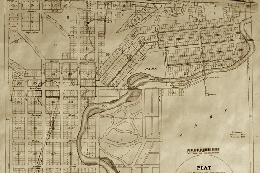
The streets and alleys of the town were platted a bit earlier, however, by a certain US surveyor named Benjamin H. Smith. In 1883, Mr. Smith had laid out the parcels of a future townsite — approximately 1,106 parcels — in strict geometric grids that had a tenuous relationship to the actual topography. Almost all of the lots measured 50 feet by 150 feet, and every parcel faced on a public street. Most parcels also had access to a public alley along the back yard.

You can click the image above to view a larger version of Mr. Smith’s 1883 plat map.
If all of Mr. Smith’s 1,106 platted lots had seen a single family house built on it, and if each were home to an average of, say, 2.5 family members, we might have expected the population of the Town of Pagosa Springs to be about 2,765. But some of the platted parcels were not buildable and still remain vacant to this day, and a fair number of the downtown lots became commercial properties (with residences on the second floor?) or churches, or schools, or government buildings.
At any rate, it would seem that, by 1940, Pagosa Springs — with a population then of 1,591 — had not yet finished occupying the 1,106 parcels platted in 1883.
Things didn’t change much for Pagosa between 1940 and 2000, in terms of population. The US Census counted 1,591 residents in the year 2000… the exact same number as they’d counted in 1940.
But we might see that coincidence as rather odd, because during the 1990s, the Town had pursued an aggressive annexation policy and had greatly expanded the town boundaries to include properties up to four miles west of the original town limits. The new Town of Pagosa Springs, in 2000, looked more like this:
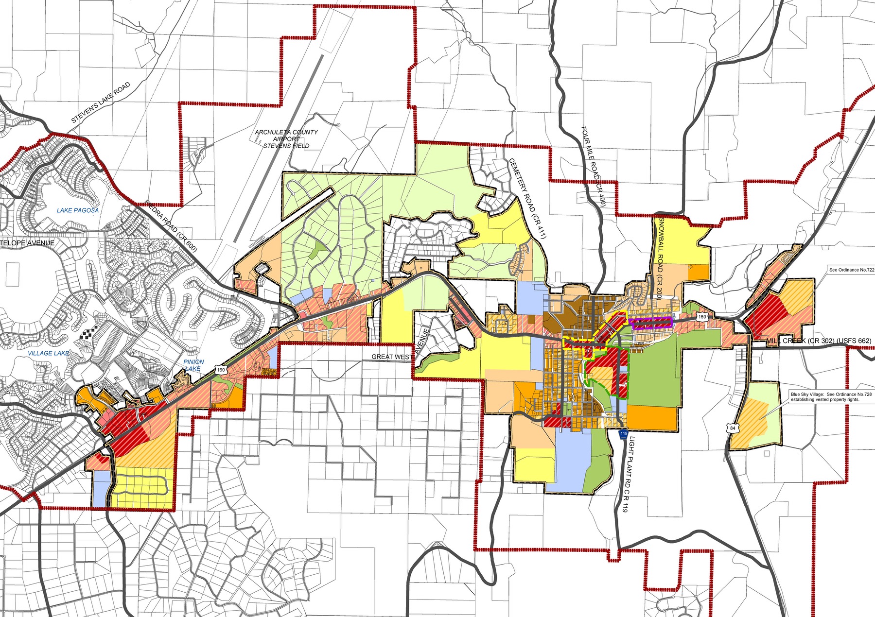
The colored areas are within the town limits, The bold red line is shows areas of possible future annexations. (You can click the image above for a larger version.)
As we said, the population of this greatly enlarged town, in the year 2000, was about 1,591. (According to the US Census.)
Yes, the same population as in 1940. But in 1940, the town had been this size:
As we mentioned already, many of the people who claim to live in “Pagosa Springs” actually live outside these expanded town boundaries, in the unincorporated county of Archuleta. Only about 15% of the total county population — which the Census currently pegs at about 13,900 — live within the town limits.
Today, the Town of Pagosa Springs might have around 1,900 people living within its boundaries. We’ll know more about that next year, when the new 2020 Census numbers are made public.
So maybe 800 households total? 800 families, subject to the Town government’s many, many rules concerning property rights.
Here’s one of those numerous rules:
3.2.5. TOWN RESIDENTIAL – MEDIUM DENSITY (R-12)
The R-12 district is intended primarily for single-family residences, duplexes, and patio homes. The district is intended for locations closer to commercial centers and near downtown, and may serve as a transition between higher-density residential areas and lower-density, single-family neighborhoods. The district should have pedestrian-oriented, connected local streets and sidewalks, as well as accessibility to parks, open space, schools, and other civic activities. The maximum density is twelve (12) units per acre.
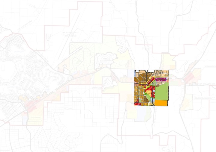
The so-called R-12 zoning is indicted in the Town zoning map by an orange color. Here’s the approximate area of downtown Pagosa that was originally platted by Benjamin Smith in 1883, showing most of the R-12 zoning located in the southwestern section of town (bottom left):
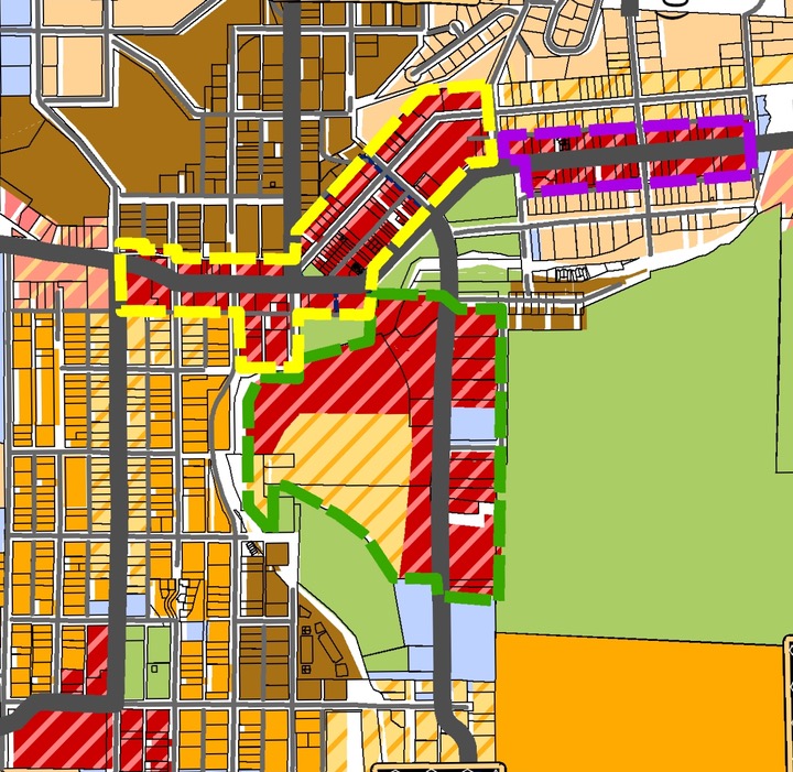
To orient yourself, the Springs Resort and the Healing Waters Resort are located about dead center on this map, in the red-hatched area. We might call this area, “The Historical Downtown” since it was originally designed in 1883.
Here’s a sentence from the above-mentioned regulations regarding the R-12 districts:
The district should have pedestrian-oriented, connected local streets and sidewalks, as well as accessibility to parks, open space, schools, and other civic activities.
When Mr. Smith platted downtown Pagosa in 1883, he was careful to create plenty of ‘pedestrian-oriented, connected local streets’ and alleys. (Automobiles had not yet taken over the design of urban areas.) If you were to walk from the southwestern corner of the historical downtown to the northeastern corner, you would have your choice of literally dozens of possible routes — combinations of public streets, public alleys, public sidewalks, and public trails — to facilitate your journey.
As you walk or drive anywhere in Pagosa’s downtown, you will pass privately owned homes, and privately owned businesses, and schools, and churches… but your journey is never hampered by closed gates blocking the public right-of-way.
This is how Pagosa was conceived from the very beginning… as a place were rights-of-way were owned by the public. As a place where we shared the public streets and sidewalks and trails and alleys. As a place where the entire town was “our community.”
Do we intend to keep it that way?
Turns out, our Town land use regulations are clearly written to do exactly that…