
This story was published in the Spring 2024 issue of ‘Headwaters’ magazine, a publication of Water Education Colorado. See the full contents here. We are sharing it in two parts.
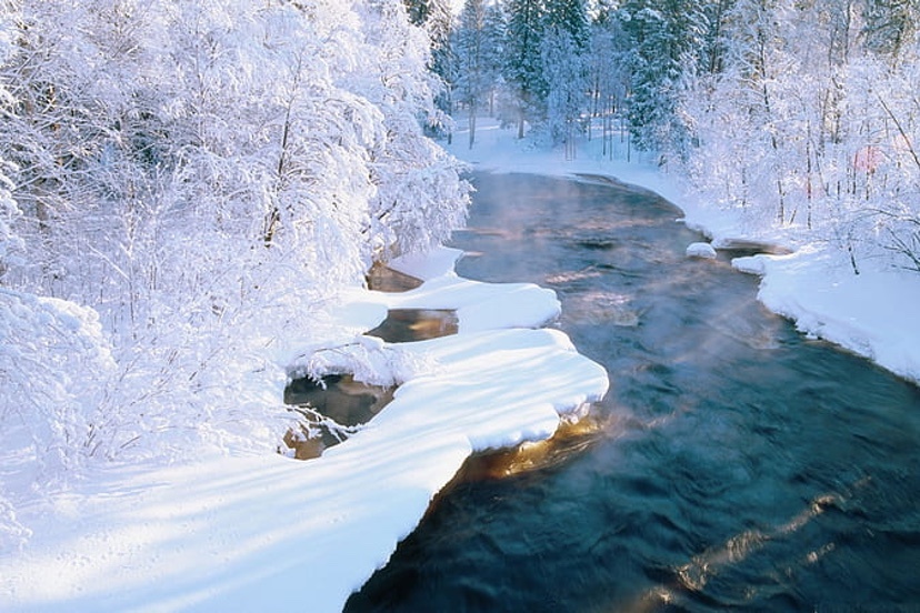
With stretched water supplies, accuracy in forecasting is increasingly important. A new tool, the high-resolution LiDAR of Airborne Snow Observatories (ASO) has meant better data on the amount of water contained in snowpack, and has improved runoff projections. Through ASO, a plane flies over entire watersheds or basins, collecting snow-depth data. Flights in 2024 include the Conejos River and the Yampa and Elk rivers.
“Whether it’s a county commissioner, a dam operator, or a division engineer, their challenge is that they’ve got a forecast of runoff, timing and volume,” says Jeff Deems, a snow scientist and part-owner of ASO. “They need to operate their headgates, their allocation, their dam, et cetera, while recognizing that their forecast is uncertain and that there’s a range of outcomes that could be undesirable. They need to make the best decision possible under that uncertain framework.”
ASO claims it can achieve 98% accuracy in forecasting the amount of water contained in snow, known as the snow water equivalent, or SWE, across large areas. Water managers across Colorado, with the help of state funding, are contracting with ASO to collect data and boost their forecasting.
“It opens up understanding of different physical processes related to the snowpack that otherwise we may not understand very well,” says Angus Goodbody, of ASO. Goodbody is a forecast hydrologist with the Natural Resources Conservation Service (NRCS).
While this data is invaluable to many water managers, NRCS can’t yet use ASO data in its modeling. But NRCS, too, is rolling out a new forecast system this winter. Goodbody describes the forecasting tools as improving incrementally. By using various forecasting tools and models to analyze data, NRCS aims to mitigate “the vulnerability of any one of those models on their own,” he says.
Digging into soil moisture
New tools have also topped Andy Rossi’s wish list for the Yampa. From the Steamboat Springs office of the Upper Yampa Water Conservancy District, where he has been the district’s general manager since 2020, Rossi directs operations of the district’s two upstream reservoirs, Stagecoach and Yamcolo, which provide water to ranches and municipalities, including Steamboat Springs.
When he started working for the Upper Yampa district as an engineer in 2009, runoff forecasts were “becoming more and more unreliable and really difficult for us to get our arms around what was going on in the basin,” he explains.
Temperature records for the Yampa Basin were very good. Soil moisture records? Not so much. Runoff predictions from past years mentioned soil moisture but relied solely on models. “There was no direct measurement of soil moisture going into our forecasting,” Rossi says. He decided the Yampa Valley needed more diverse measuring infrastructure to better collect data about soil moisture and atmospheric processes in order to see if and how soil moisture factors into runoff. Were dry soils sapping runoff, preventing it from reaching rivers? The puzzle was missing pieces. Integrating more non-snow data into runoff projections might result in better forecasts.
A partnership began to coalesce in 2018 between the Yampa Valley Sustainability Council, Colorado Mountain College, and the Scripps Institution of Oceanography’s Center for Western Weather and Water Extremes. Guided by a team of 15, the collaboration yielded a pilot soil moisture and weather monitoring station in September 2022 near Stagecoach Reservoir. In 2023, with aid from the Colorado Water Conservation Board and the Colorado River District, two additional stations were installed in the basin.
The team in early 2024 was working on six more stations upstream of Craig. The stations collect continuous soil moisture measurements and data on meteorological conditions with the goal of sharing that data so that stakeholders can make management choices about changing water supplies.
The aim, in part, was to generate new and valuable data that wasn’t being collected elsewhere, says the sustainability council’s Madison Muxworthy, the project manager. “We didn’t want to duplicate existing efforts, such as SNOTEL stations,” she says.
The sustainability council has collaborated with the NRCS to install more soil moisture sensors at SNOTEL stations to go along with snowpack, precipitation and temperature data. The team will install four stations this summer and two more in 2025.
It’s still too soon to know the results of this monitoring. Measurements obtained from these new stations may reveal short-term changes, but other insights may require 10 to 20 years of data.
Soil moisture and groundwater
A similar network of soil moisture stations already exists in Colorado’s Roaring Fork Valley. There, 10 stations have been installed in an elevation band of 5,880 feet from Glenwood Springs to above 12,000 feet at Independence Pass. All stations have sensors to monitor soil moisture at depths of 5, 20 and 50 centimeters, and monitor soil temperature at 20 centimeters deep. They also record air temperature, relative humidity, rainfall, and more, recording measurements at least hourly.
This network was created by the Aspen Global Change Institute in response to local interest in measuring soil moisture in the Roaring Fork watershed. In 2012, as bark beetles proliferated, scientists at a small meeting on forest health identified soil moisture as a critical, understudied component of ecosystem vitality. With more than a decade of measurements, the data may help answer questions about hydrology and ecology in mountain systems.
Key research questions for the Roaring Fork network include how will climate change impact water availability and timing in the watershed? And how can in-situ soil moisture data be used in water supply forecasts and models to better inform decision making for water managers and cities?
Elise Osenga, the Aspen Global Change Institute’s community science manager, stresses the complexities of runoff now further confused by climate change. Soil moisture plays a role, but it’s among many factors.
“You’re trying to predict the future based on how conditions played with each other in the past,” explains Osenga. “And now in the future, different wrenches will be thrown into the system where the past may not be a perfect representation.”
If dry soils only tell a small percentage of the story of this runoff thievery, that’s where the institute’s microscope is being applied. “Finding the quantitative relationship between a dry soil and change in runoff is going to be hard because it’s a small percent to begin with. It’s not that it doesn’t matter, but it’s also not the silver bullet,” Osenga says.
Soil moisture refers to water held in the pores of soil. Going deeper – the depth varies but often begins around a meter down—takes you to a saturated zone of groundwater. Groundwater adds further complexity to the question about runoff prediction. Rosemary Carroll is conducting research on that interplay. She’s a research professor in hydrology affiliated with the Desert Research Institute but based at Colorado’s Mt. Crested Butte.
Groundwater, she says, moderates flows between the years of big water and high flows and those of lesser runoff. During the big years, the water goes into storage in the form of groundwater. It stabilizes flows.
But groundwater declines during hotter and drier years—think 2002, 2012 and 2018. Streamflow is sensitive to declines in groundwater storage, Carroll says, so flows also drop. Modeling that Carroll has worked on shows a loss of 30% in streamflows over the next century or so, assuming a 4 degree temperature increase.
Groundwater may seem to be on the margins of why runoff predictions on April 1 fail to materialize in July, but Carroll believes it needs to be part of the discussion. That connection will become more important in coming decades as temperatures continue to rise. “It’s really important, and it’s not often talked about,” she says.
Late season weather prediction accuracy
Despite all this research that seeks to narrow the uncertainty, uncertainty will remain in streamflow forecasting for the foreseeable future. That’s the conclusion drawn by Peter Goble, of the Colorado Climate Center, and Russ Schumacher, Colorado State Climatologist, in a study published in the Journal of Hydrometeorology December 2023 issue.
“What influences seasonal runoff more: antecedent soil moisture and groundwater conditions or meteorological conditions following April 1?” they asked. Sifting through evidence from 2020 and 2021, they reached a clear conclusion: “This study demonstrates that existing soil moisture and groundwater models are unlikely to provide ‘low-hanging fruit’ for improving forecasts.”
Improved weather forecasting skills will matter more, Goble and Schumacher said.
Weather forecasts are remarkably good for a week to 10 days. Beyond? Not so much. Will that change? Goble and Schumacher indicate little optimism.
Then there’s the shifting climate. If weather continues to become more variable, “that is only going to decrease our ability to predict ahead of time what the runoff is going to be,” Goodbody says. Too, if warmer winter temperatures produce more rain, there will be less snow to measure. “Then predictability by definition goes down until we actually can predict the future [after April 1] weather with more certainty,” Goodbody says.
Improved forecasts, however, won’t deliver more water. For management purposes, stored water still matters greatly. Consider the Yampa River after that three-wire winter of 2023. The rapidly slackening flows of the river through Steamboat during July surprised water managers and state officials. That year, the snowpack in the Yampa River Basin was dusty, moving the snow to melt and runoff to occur earlier than usual. Officials came close to closing the river to commercial fishing access, as they had the four previous years because of either low flows, high temperatures, or both.
Through a water lease agreement orchestrated by the Colorado Water Trust—a nonprofit that uses voluntary water-market transactions to restore streamflows — the Upper Yampa district released between 18 cubic feet per second and 40 cfs from Stagecoach from late August through late October to keep the Yampa flowing and at a cooler temperature. This added water helps the City of Steamboat Springs stay in compliance with federal water quality standards governing stream temperatures below the city’s wastewater treatment plant. It also benefits fish and those angling at them.
“We thought we were in great shape and thought we wouldn’t need [special] releases out of Stagecoach [Reservoir],” says Julie Baxter, water resources manager for the City of Steamboat Springs.
“It was definitely a big surprise.”

Allen Best publishes the e-journal Big Pivots, which chronicles the energy transition in Colorado and beyond.