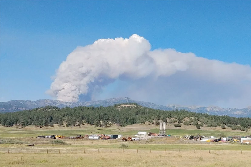
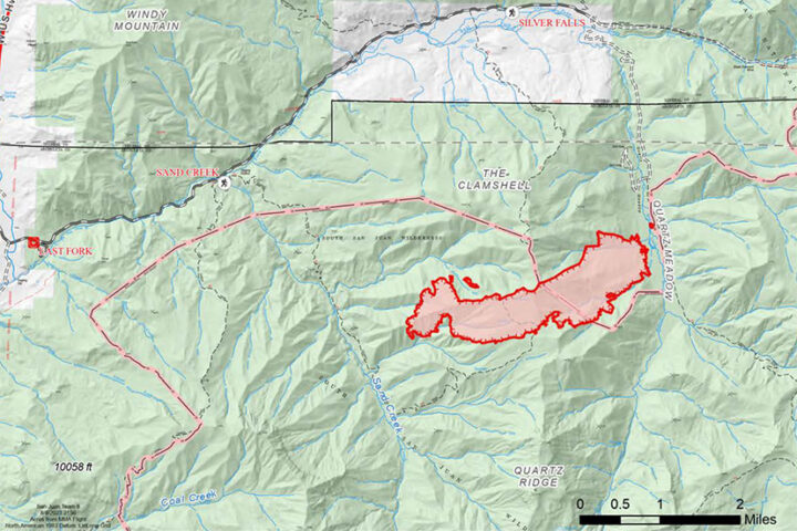
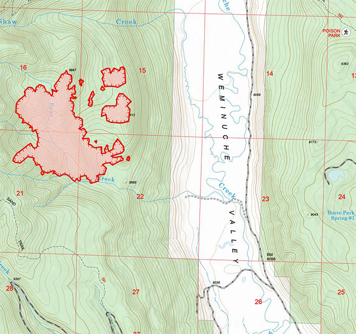
PHOTO: Quartz Ridge Fire, earlier this week.
From the morning of August 9.
Quartz Ridge Fire
Fire start date: August 5, 2023
Fire size: 1,133 acres
Containment: 0%
Location: 13 miles Northeast of Pagosa Springs, Colorado
Personnel: 39
Cause: Lightning
Management: Suppression
Evacuation Information: There are no current evacuations. Local residents should follow incident information for updates.
Firefighter and Public safety will be the highest priority throughout all phases of the incident.
Fire managers continue to develop plans for when the fire reaches terrain more favorable for engagement. Firefighters are unable to directly engage due to very steep terrain, its remote location, and firefighter risk associated with working in standing dead and down trees. Aviation assets are ineffective if ground resources are not in place to utilize water and retardant, so only an aerial supervision aircraft will be used today for planning and reconnaissance. The fire area in the South San Juan Wilderness is extremely steep and heavily loaded with dead timber both standing and down; this contributes to more intense fire behavior and elevates risk to firefighters and aviation. A National Incident Management Organization Team has been ordered to assume command of the incident August 12th at 0600, providing additional capacity and oversight to the incident.
August 9 Accomplishments: Local ground fire resources continued to directly monitor fire growth and directional spread. San Juan Type 3 incident Management Team (IMT) assumed fire command, and is working with local cooperators began developing long-term, strategic plans for fire suppression.
Current Plan: Incident Management Team operational leadership will recon the fire area with aviation resources assigned to the fire, developing real-time situational awareness.
Incoming firefighting resources will be briefed on-incident and assigned operational objectives. Significant national competition for resources on higher-priority fires has led to a delay in obtaining the number and types of resources needed.
Continue to develop Management Action Points, which are clearly specified incident conditions that, when reached, prompt a predefined fire management action or trigger the implementation of new strategies/tactics.
Communicate with landowners, affected utilities, and county stakeholders.
Bear Creek Fire
Fire start date: August 1, 2023
Fire size: 283 acres
Containment: 0%
Location: 23 miles Northwest of Pagosa Springs, Colorado
Personnel: 47
Cause: Lightning
Management: Suppression
Evacuation Information: There are NO pre-evac/evacuation orders at this time. Local residents should follow incident information and updates.
Firefighter and Public safety will be the highest priority throughout all phases of the incident.
Fire managers continue to develop plans for when the fire reaches terrain more favorable for engagement. Firefighters have been unable to directly engage due the dangerous loading of dead timber both standing and down. Firefighters are prepared for when the fire backs down to the Weminuche Valley, providing an anchor point for them to begin suppression operations. Structure protection operations are underway and will continue today. Crews will monitor the fire overnight. A National Incident Management Organization Team has been ordered to assume command of the incident August 12th at 0600, providing additional capacity and oversight.
August 9 Accomplishments:
Firefighting crews in the Weminuche Valley area assessed risk level to private land/structures and developed and began implementing structure protection plans. Local ground fire resources continued to directly monitor fire growth and directional spread. These observations are critical to assessing the probability of success of the current incident strategy being achieved. San Juan Type 3 incident Management Team (IMT) assumed fire command.
Current Plan: Structure protection groups will continue risk assessments and will set up structure protection equipment.
Operational overhead will continue scouting indirect control opportunities to the south along the Mosca Road, tying that east into the Weminuche Valley.
Incoming firefighting resources will be briefed and assigned operational assignments. Significant national competition for resources on higher-priority fires has led to difficulty in obtaining the number/types of resources needed.
Continue to collaboratively develop Management Action Points (MAP) with cooperators and stakeholders. MAPs are clearly specified incident conditions that, when reached, prompt a predefined fire management action or trigger the implementation of new strategies/tactics.
Communicate with landowners, affected utilities, and county stakeholders.


