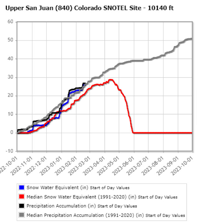
Pagosa Area Water and Sanitation District Manager Justin Ramsey sent out a press release this morning, with an update on the PAWSD water situation. Much of the water that serves the Pagosa Springs area during the busy summer months comes from the winter snow pack in the San Juan Mountains, and that snow pack, and the estimated amount of water it contains, is monitored on a daily basis during the ‘water year’ — October 1 through September 30.
Here’s the SNOTEL monitoring chart for February 20, 2023. The historical median for February 20 is about 21.4 inches of ‘Snow Water Equivalent’. This morning’s report gives the SWE as 25.9 inches.
As we see, the chart begins on October 1, 2022. The peak snow pack normally occurs around mid-April.

The gray line in the chart represents the historical ‘median’ precipitation. and the black line shows the current accumulation for this year. As we can see, the accumulation this year about average.
The red line shows the historical ‘median’ snow pack water content — an average of the years 1991-2020 — while the blue line shows this year’s SWE which is above the historical ‘median’ compared to previous ‘February 20’ averages.
