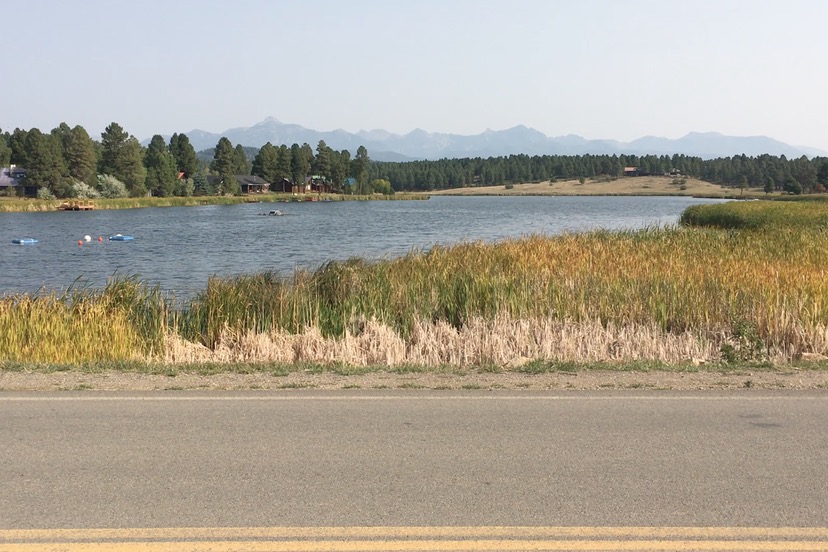
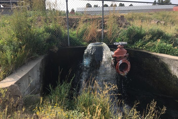
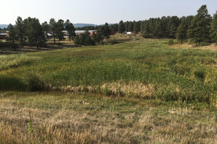
PHOTO: Lake Forest, also known as Borns Lake Reservoir, and the suburban neighborhood just north of the Vista Waste Water Treatment Plant.
We heard some pleasant news, earlier this week, about the primary uses of domestic water within the Town of Pagosa Springs — the ‘primary domestic uses’ being cleaning, washing and flushing, all of which send dirty water into the Town’s waste water system. That system then pumps the dirty water uphill through a seven-mile pipeline to the Vista Waste water Treatment Plant operated by the Pagosa Area Water and Sanitation District (PAWSD).
The good news concerned the continually-failing pumps that the Town sanitation workers have been trying to keep running over the past three or four years. Apparently, the engineers who designed the system specified the wrong types of pumps, and it took a new engineering firm to identify the problem and specify the correct pumps.
Following the installation of the new pumps, the system seems to be operating at close to 100% efficiency. (We will have to patiently wait and see, however.) The repairs were not cheap, however. The number “$800,000” was mentioned.
During the Town Council discussion on Tuesday, we learned that no one is yet sure how many additional homes and businesses can be added to the Town sewer system before it begins to fail again. A computer ‘model’ is being run to look at that question.
But for the time being, things are looking up. Fingers crossed.
I mention this news because we’re talking, in this editorial series, about water diverted out of the San Juan River, and as it turns out, nearly all the water that eventually flows through the Town’s uphill sewer pipeline comes directly from the San Juan River, via the Snowball Water Treatment Plant.
It doesn’t, however, get returned directly to the San Juan River following treatment. The Vista plant outflow spills into the Borns Draw, which then flows into Martienz Creek (when the outflow is sufficient). Martinez Creek spills into Stollsteimer Creek, which then flows into neighboring Piedra River.
As was mentioned yesterday in Part Four of this editorial series, the Southwest Basins Roundtable Colorado has been sharing an informative, interactive map on their website, indicating some of the ways water is used in our corner of Colorado, and how taxpayer funding has been allocated for various water projects. I discovered the map this week.
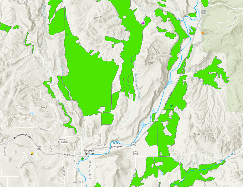
Here’s a zoomed-in screen shot from the map page, showing downtown Pagosa Springs and the nearby area to the northeast. The green shapes indicate irrigated ranches, ranging in size from 2.5 acres to 813 acres. In 2017, about 18,000 acres of grass pasture were irrigated in Archuleta County (according to the US Department of Agriculture.) That acreage is considerably less than the 24,000 acres irrigated in 2012.
Taking a wild guess, we are looking at about 2,500 acres of irrigated pastures in the screenshot below.
As a member of the PAWSD board, I have a particular interest in two things in this region of the map. One is the former Running Iron Ranch, which was purchased from the Weber family in 2008 for $10 million — purportedly on behalf of local taxpayers — and designated as the site for the future Dry Gulch Reservoir project, which was in turn priced in 2009 at a potential cost of $357 million.
To date, the reservoir has not been constructed. But certain people are still trying to convince the community that the reservoir is a good idea.
Disclosure: I currently serve on the Pagosa Area Water and Sanitation District (PAWSD) board of directors, but this editorial reflects only my own personal opinions, and not necessarily those the PAWSD board as a whole.
The other thing of particular interest to me is the fact that colored stars on the map indicate important water projects, as identified by the Southwest Basins Roundtable.
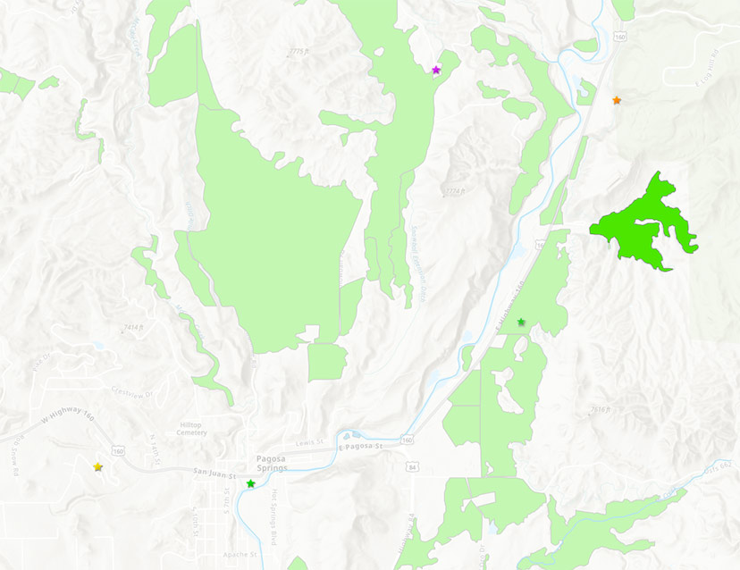
Here, below, is the same map, with the Running Iron Ranch highlighted in green, and also highlighted, the nearby ‘important projects’.
About 132 acres of the Running Iron Ranch is currently operated as irrigated grass pasture. It’s one of the many irrigated pastures that, all together, divert about 95% of the water extracted from the San Juan River and its tributaries within Archuleta County.
As we note, the Running Iron Ranch is not marked by a star. This might indicate that the Southwest Basins Roundtable no longer considers the Dry Gulch Reservoir as a viable project. Or, it might be an oversight?
A few weeks ago, a report was delivered to the San Juan Water Conservancy District (SJWCD) by the Lakewood engineering firm, Wilson Water Group, to help the SJWCD board develop some reasonable policies about how to best help Archuleta County meet its water demands in the future.
Unfortunately, the Wilson Water Group provided less than a one-page discussion of agricultural water diversions , in their 24-page report.
The report does not mention the actual amount of water extracted by irrigated ranches in Archuleta County. That seems like a serious oversight, if indeed agriculture is responsible for 95% of all diversions in the community.
Nor does the report tell us what the Wilson Water Group means, exactly, when they use the term “annual irrigation shortages”. Does it mean, “the grass grows more slowly”? That fewer cows allowed into the pasture? That ranchers go out of business?
I hope it’s not just an excuse to create an essentially meaningless graph, to take up space in a 24-page report.
From the very brief discussion about agricultural water ‘shortages’ in the Wilson Water Group report:
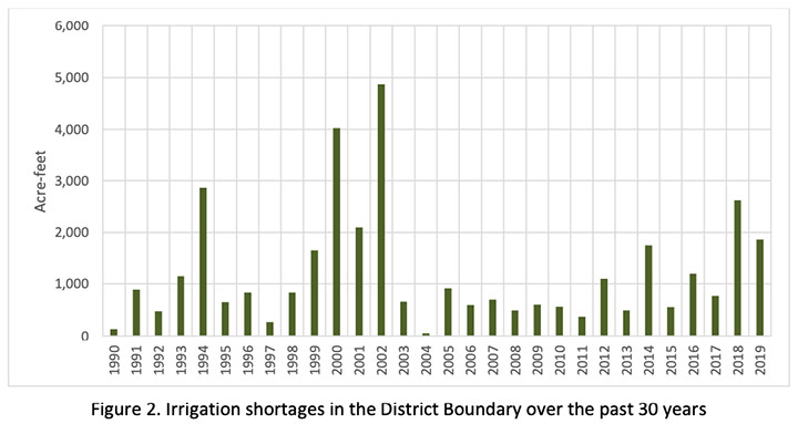
As shown in Figure 2, annual irrigation shortages ranged from around 50 acre-feet in 2004 to almost 5,000 acre-feet in 2002, with an annual average shortage of 1,200 acre-feet over the period 1990 through 2019. As expected, higher shortages occur in dry years such as 2002, 2018, and 2019. Access to storage could help agricultural producers in the District reduce irrigation shortages during drought years.
When someone talks about ‘access to storage’ for agricultural producers, they really ought to explain how water stored in a reservoir in the Dry Gulch Valley would be physically delivered to irrigated ranches spread all across Archuleta County.
And when scientists and engineers use terms that have no clear definition, it makes it difficult to elected and appointed leaders to make intelligent decisions.

