I took a walk with my camera through downtown Pagosa Springs on Saturday, January 25 — the second day of Winterfest, one of the community’s most popular wintertime events. Balloon ascensions. The annual Penguin Plunge. Skijor races. The Barkus Parade, featuring dogs dressed in costumes. A Nordic ski biathlon. The Sledz on Rez competition. Chamber gala and awards ceremony.
Overall, a great way to combat cabin fever.
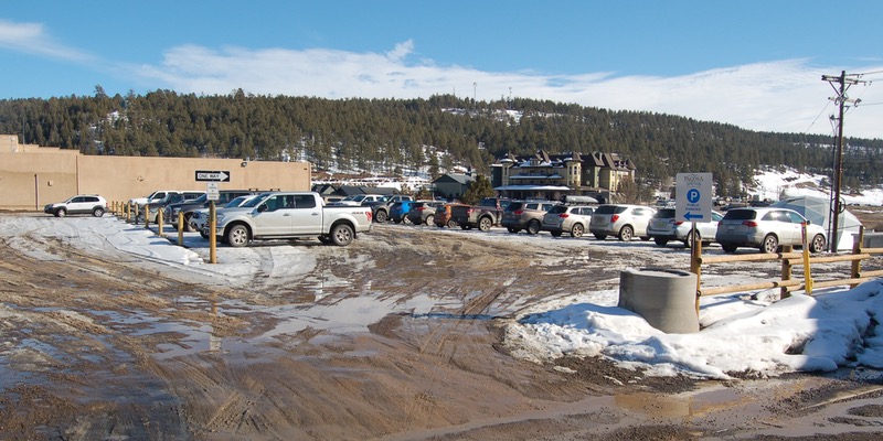
The Town parking lot adjacent to the County Courthouse was more than half full, due to the numerous downtown events. The Town government has developed this parking lot on a trial basis, as an experiment, at the intersection of Lewis Street and Main Street (Highway 160.)
I also took a walk the following day, January 26 — the final day of Winterfest — in the late morning.
Sunday. A day of religious worship for many Pagosans.
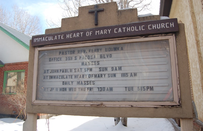
We have a couple of churches on Lewis Street — Immaculate Heart of Mary Catholic Church and Community United Methodist Church — and the Town government allows ‘diagonal parking’ on Sunday mornings to accommodate the church-goers. Attendance at the Immaculate Heart has dropped off somewhat since the construction of the Pope John Paul II church, uptown near the Pagosa Springs Medical Center; the diocese now offers only one mass each week at the downtown location.
The Methodist Church, remodeled and enlarged in 2009, seems to draw a decent crowd for its Sunday services. As noted, the Town makes special accommodations for the two churches by allowing diagonal parking on the south side of the street — on Sundays only. Diagonal parking is generally considered to be less ‘safe’ than parallel parking, mostly because the driver has limited visibility when backing out of a diagonal space. Diagonal parking also protrudes much father into the traffic lanes (as you can see in the photo below.)
But diagonal parking also accommodates 30%-40% more vehicles than parallel parking does, within the same stretch.
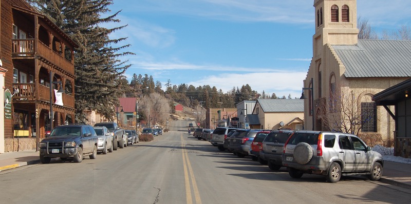
The vehicle lanes on the 400 block of Lewis Street used to be a bit wider, and a bit more accommodating to parked cars — diagonal or otherwise — prior to 2008 when the Town government spent about $1.2 million reconstructing this downtown block with wider sidewalks, new street lamps and street trees, in hopes of encouraging festivals and street fairs in downtown Pagosa.
The reconstruction project also added ‘bump-outs’ at the crosswalks, to slow traffic and help facilitate a pedestrian-friendly downtown. That’s been one of the key goals of our Town government, for at least the last couple of decades. A walkable downtown.
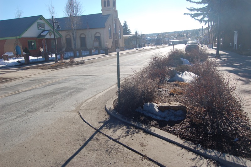
Considerable excitement — and high hopes for increased downtown vitality — surrounded the decision to rebuild this historical downtown block. The Town Council envisioned new, more successful commercial businesses blossoming along the wider, festival-friendly sidewalks.
Here’s Lewis Street, later the same day… Winterfest Weekend… 2:30pm. Church services are over.
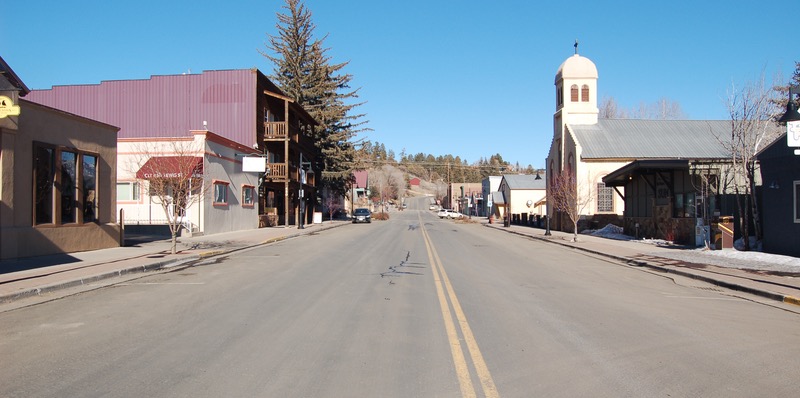
The results of a $1.2 million street project have been disappointing, these past 12 years, in terms of downtown vitality. The ‘festival street’ never became a festival street. Event organizers usually opt to hold events, fairs and festivals in other places around town — Town Park, Reservoir Hill, Yamaguchi Park, Pagosa Springs High School, or a vacant 27-acre parcel on Hot Springs Boulevard.

The only event typically taking place along Lewis Street has been the annual two-day Pagosa Car Show… and even that event relocated to Town Park last summer. (I believe the 2020 car show will once again return to Lewis Street.)
The two churches are still here, but the loss of the Adobe Building to fire in 2016 put a huge dent in the street’s vitality. Also, CenturyLink and Black Hills closed their offices. The funeral parlor went out of business. I would guess (…just a guess…) that the street gets less vehicle and pedestrian traffic than it did in 2007.
Ray’s barber shop is still here. The two buildings on either side are used only as big storage units, seems like.
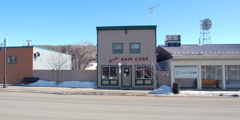
While I was walking up and down Lewis Street on Sunday afternoon, taking pictures for about 10 minutes, I saw a grand total of zero pedestrians.
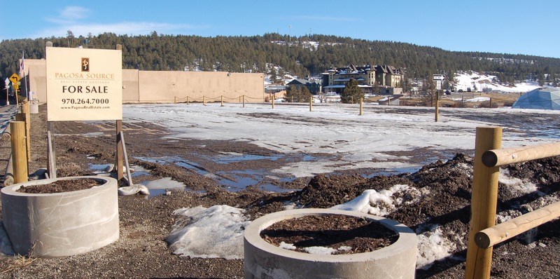
I then strolled down to the Town parking lot next to the Courthouse — the one that had been more than half full on Saturday. The Town leased this perpetually-vacant parcel last summer to increase the amount of parking available in the heart of downtown. Here’s how the parking lot looked on Sunday afternoon, on a relatively busy winter weekend.
Many US cities have been struggling, for several decades, to create a new kind of urban experience — one based on the intimacy and friendliness produced when people walk from place to place, rather than depending only on mechanized transportation: cars, pickup trucks, SUVs.
Pagosa Springs was, once upon a time, eminently walkable. When the town as originally platted in 1883, the surveyors seemed to know, innately, the right size for a small town. You could walk from one end of town to the other — east to west, or north to south — in maybe 20 minutes. Everything was within walking distance… which was a good thing, considering the automobile would not be invented for another three years, and would not become affordable for middle class families until the Model T began rolling off the assembly line in 1908.
The current Pagosa Springs Town Council and staff displayed their interest in making the town more walkable when they defined their visions for Pagosa’s future at last summer’s Council retreat. Of the fifteen long-term goals defined at the retreat’s conclusion, six of them mentioned pedestrians, sidewalks, trails, or “park-and-walk” solutions for downtown. These are not new ideas. Pagosa’s leadership has been talking about creating a walkable town for 20 years, at least.
I found a website this past weekend called Walk Score, a Seattle, WA based company using digital technology to promote the same concept. WalkScore is the parent company of Redfin.
From the WalkScore website:
Walk Score’s mission is to promote walkable neighborhoods. Walkable neighborhoods are one of the simplest and best solutions for the environment, our health, and our economy.

Our vision is for every property listing to read:
Beds: 3
Baths: 2
Walk Score: 84.
We want to make it easy for people to evaluate walkability and transportation when choosing where to live.
Walk Score uses geographic information systems to rank neighborhoods, and even individual homes, by their proximity to necessary and desirable services. The more services within walking distance, the better your Walk Score.
So I was curious. Just how walkable is our community, in 2020?
